The case study on debated dams and hydropower projects in Western and Southern Europe examines the tension between the need for carbon-free energy and the consequences of large-scale transformations of landscapes and hydrological systems.
The case study became the starting point for the ongoing long-term project DISTURBED HARMONIES [ANTHROPOCENE LANDSCAPES].
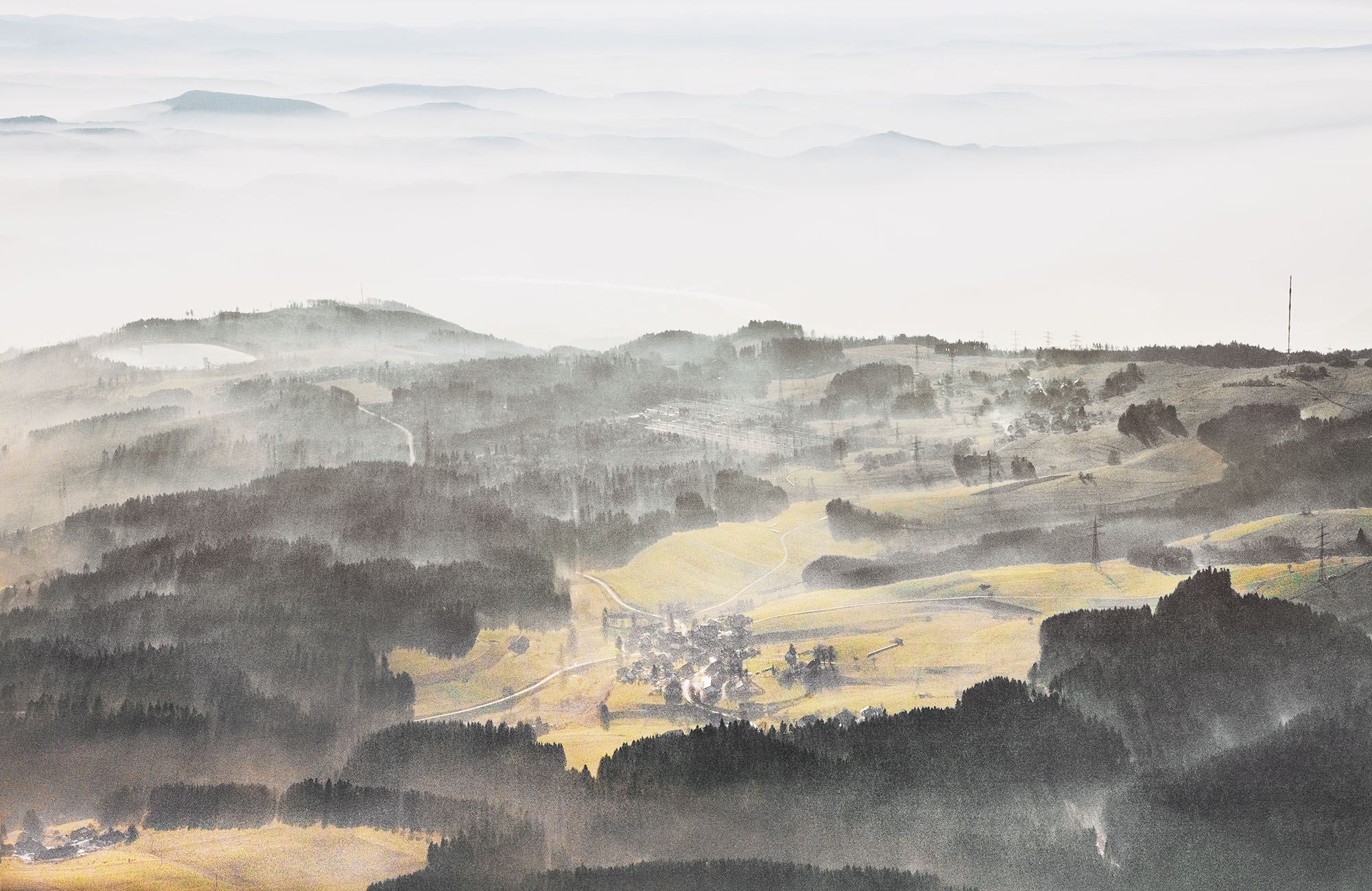
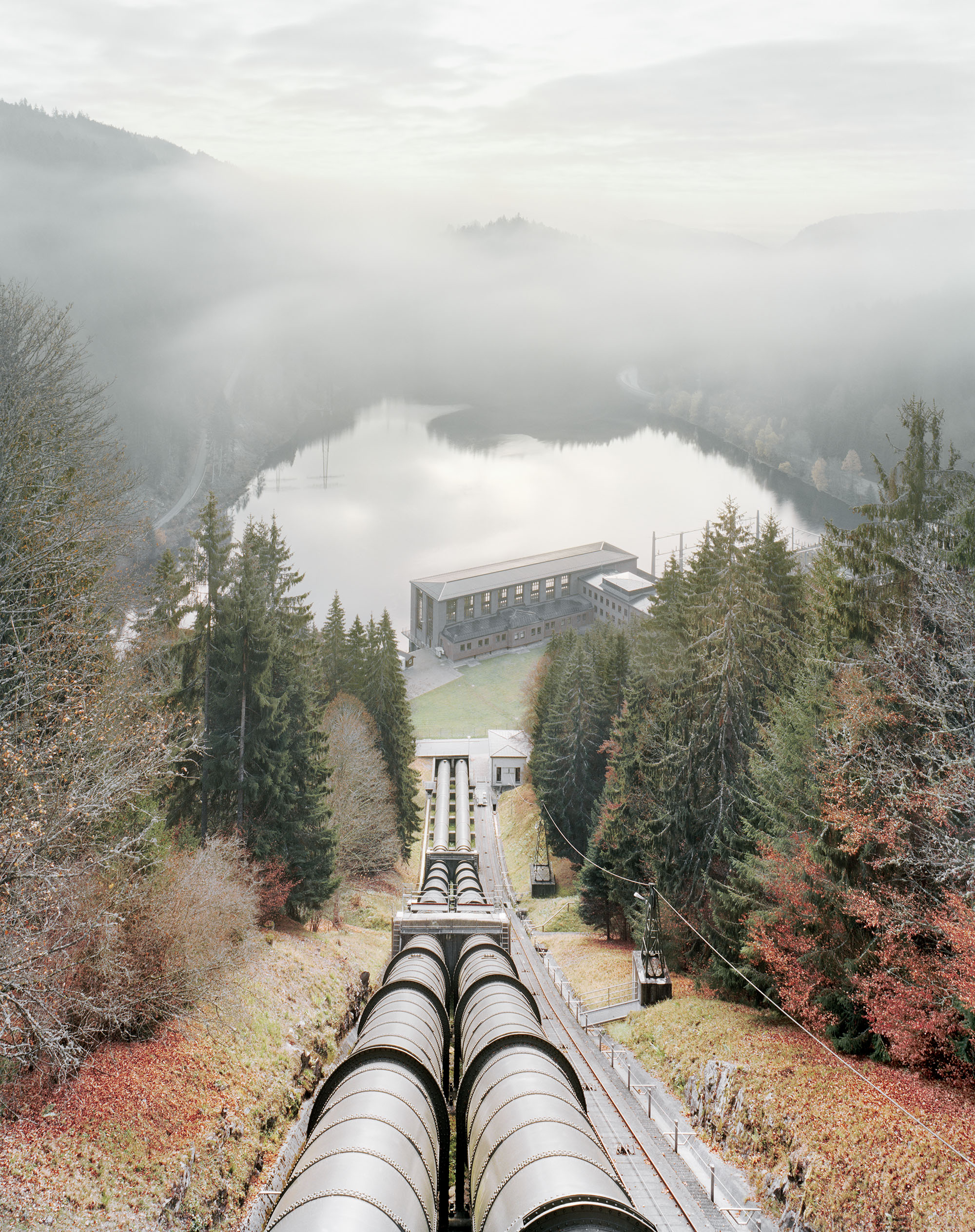
Aerial view of Säckingen pumped-storage power plant and Kühmoos transformer station with river Rhine in the background
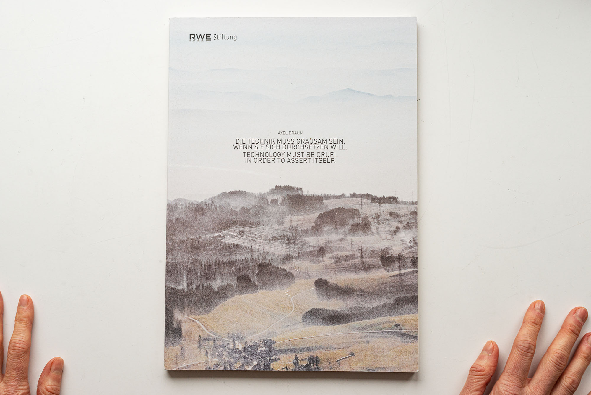
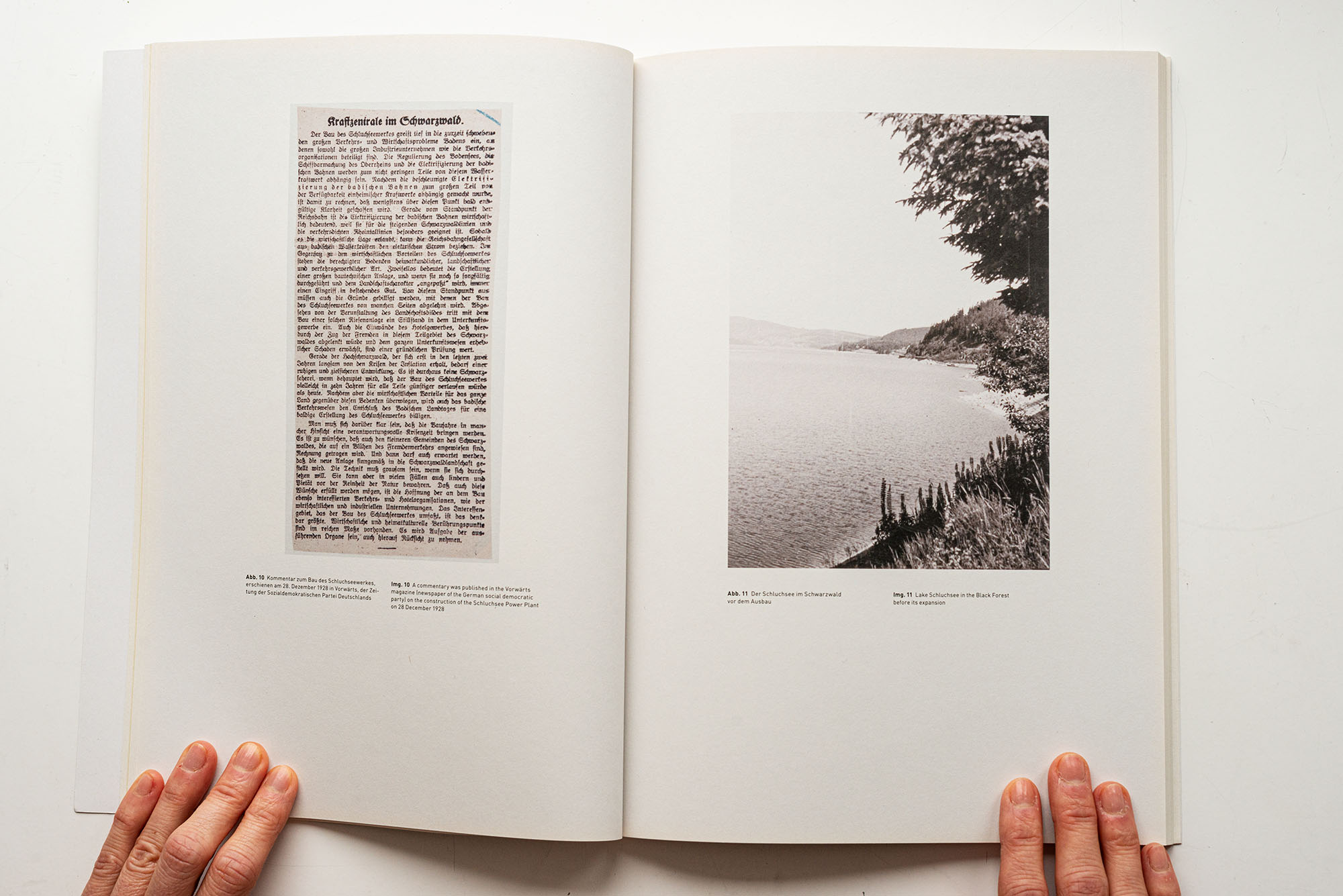
After several weeks of archive research in the Corporate Historical Archives of RWE AG, a prominent German energy company, I visited a selection of sites to complement my collection of historical material with new photo productions. The material was contextualised in archive folders and an artist book. The title is a quotation from an article in the social democrat newspaper Vorwärts from 1928, arguing in favour of building a dam in the Black Forrest.
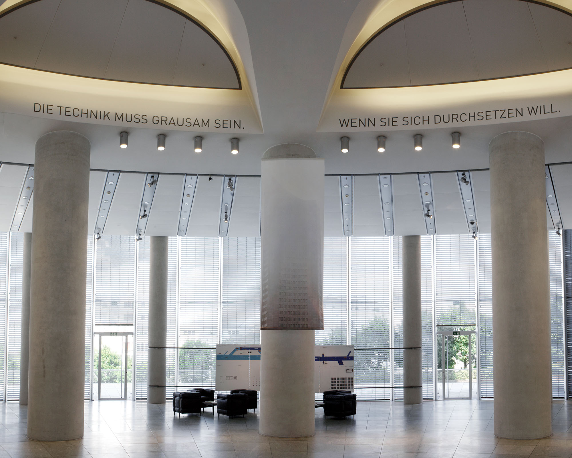
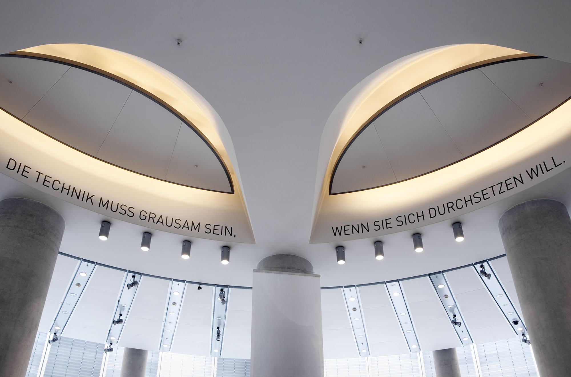
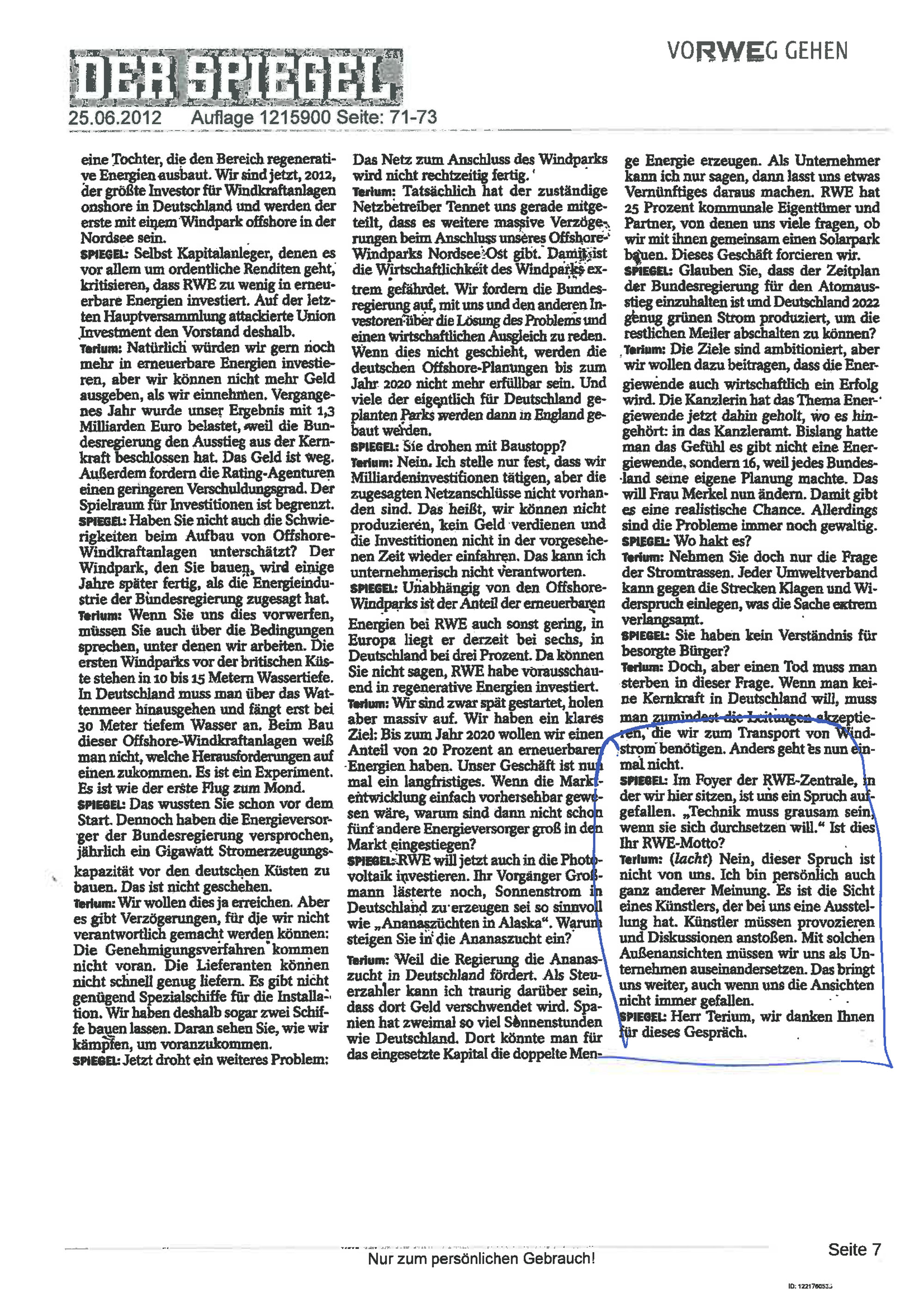
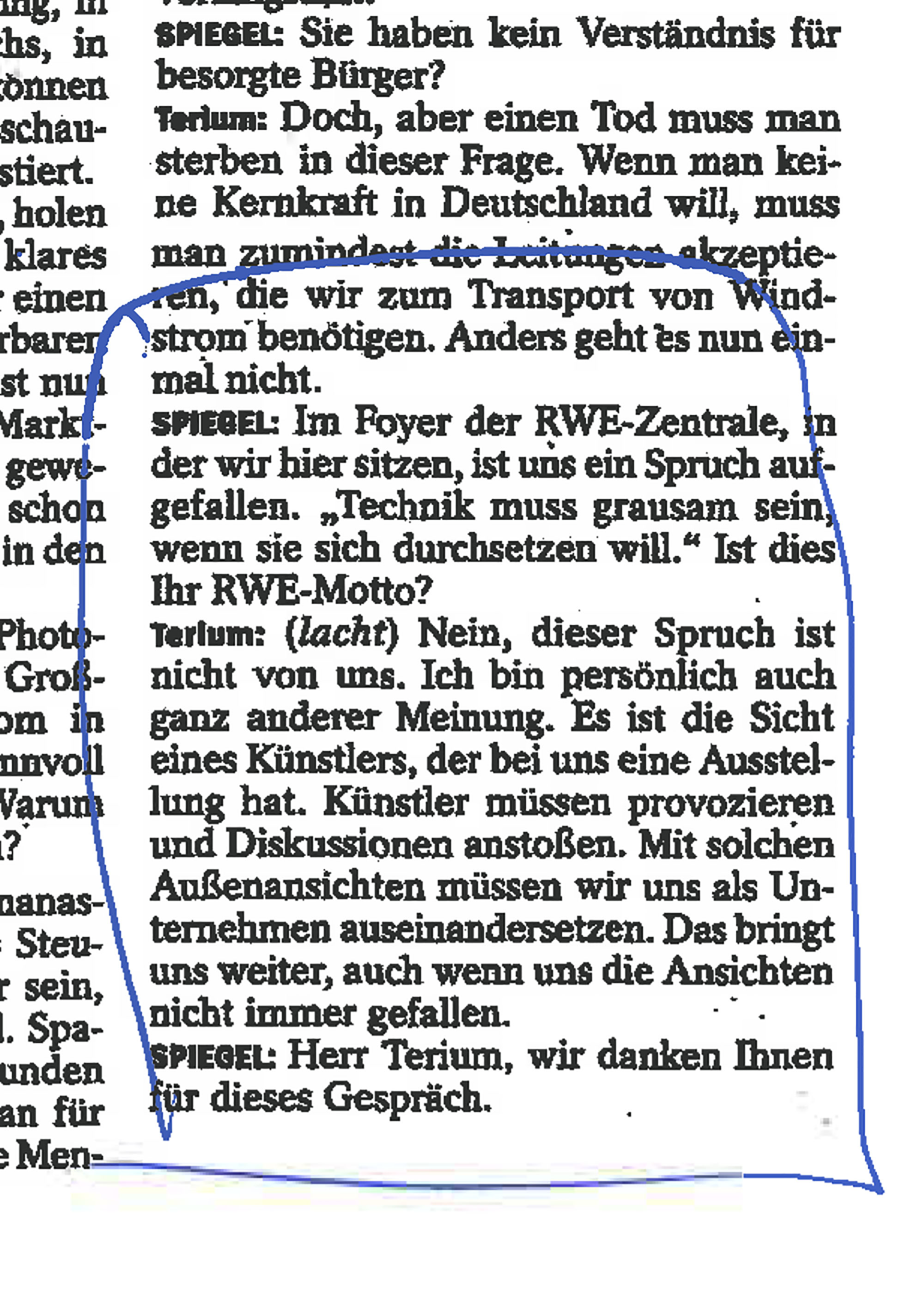
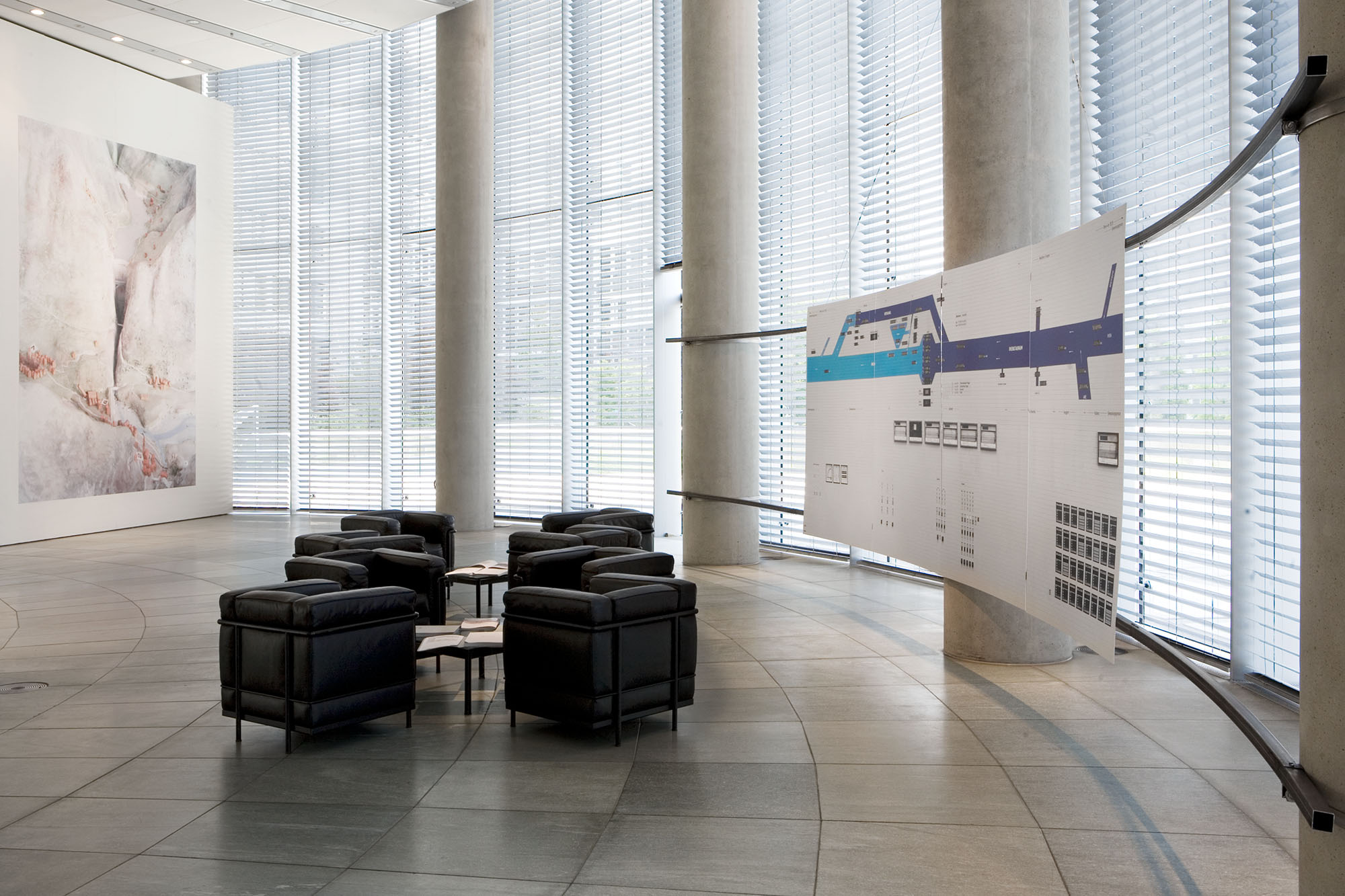
The first presentation of the project was an installation in the entrance hall of the corporate headquarters of RWE AG. The exhibition sparked controversial discussions in and outside the company. In these processes, the title played an important role: it was, e.g. taken up by Der Spiegel and has been quoted by then CEO Peter Terium in public speeches repeatedly to express the company’s openness to criticism.
ARTIST BOOK


Offset print, 88 pages, 210 mm x 297 mm, 300 copies
Project manager: Daniela Beglehn
Concept and design: Axel Braun
Design and typesetting: Johanna Unterberg
Print: Lechte Medien, Emsdetten
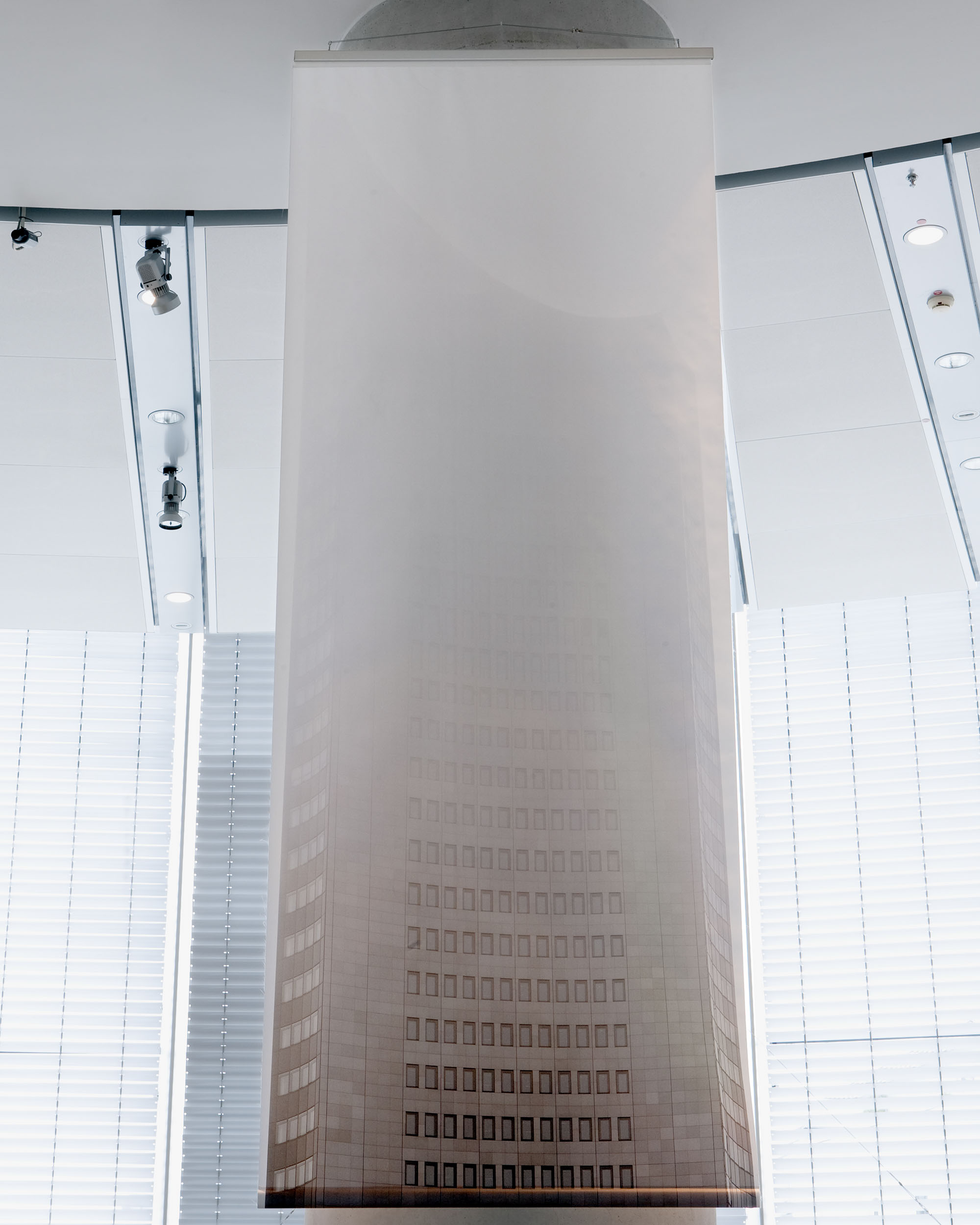
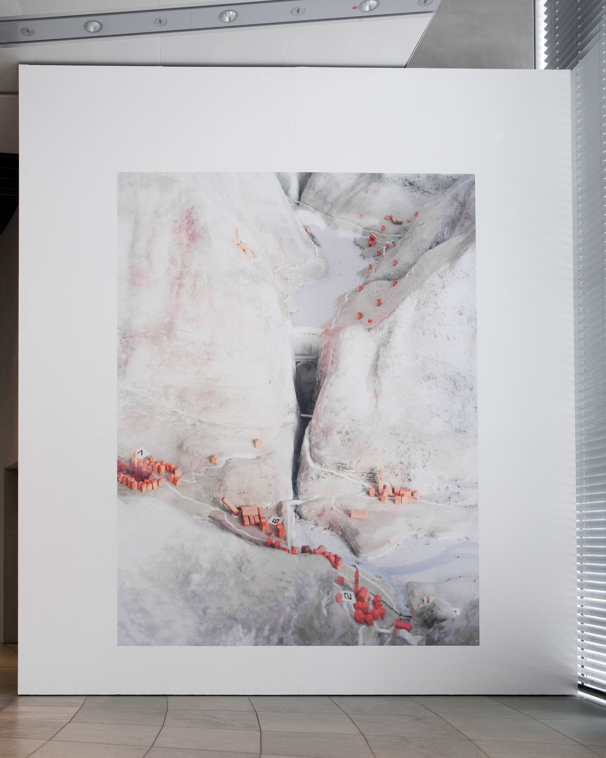
INSTALLATION VIEWS
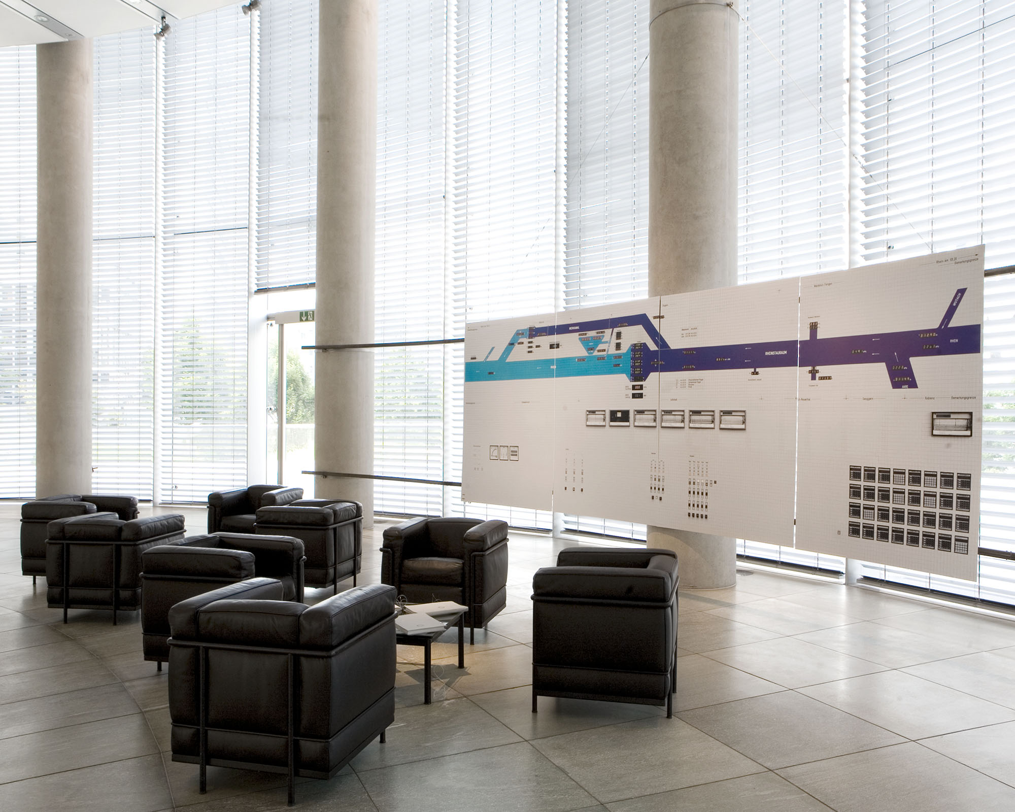
inkjet prints on Forex on steel construction, inkjet print on glass fibre banner, arrangement of lobby furniture as a forum to present research folderswall text, cut plot out of adhesive film
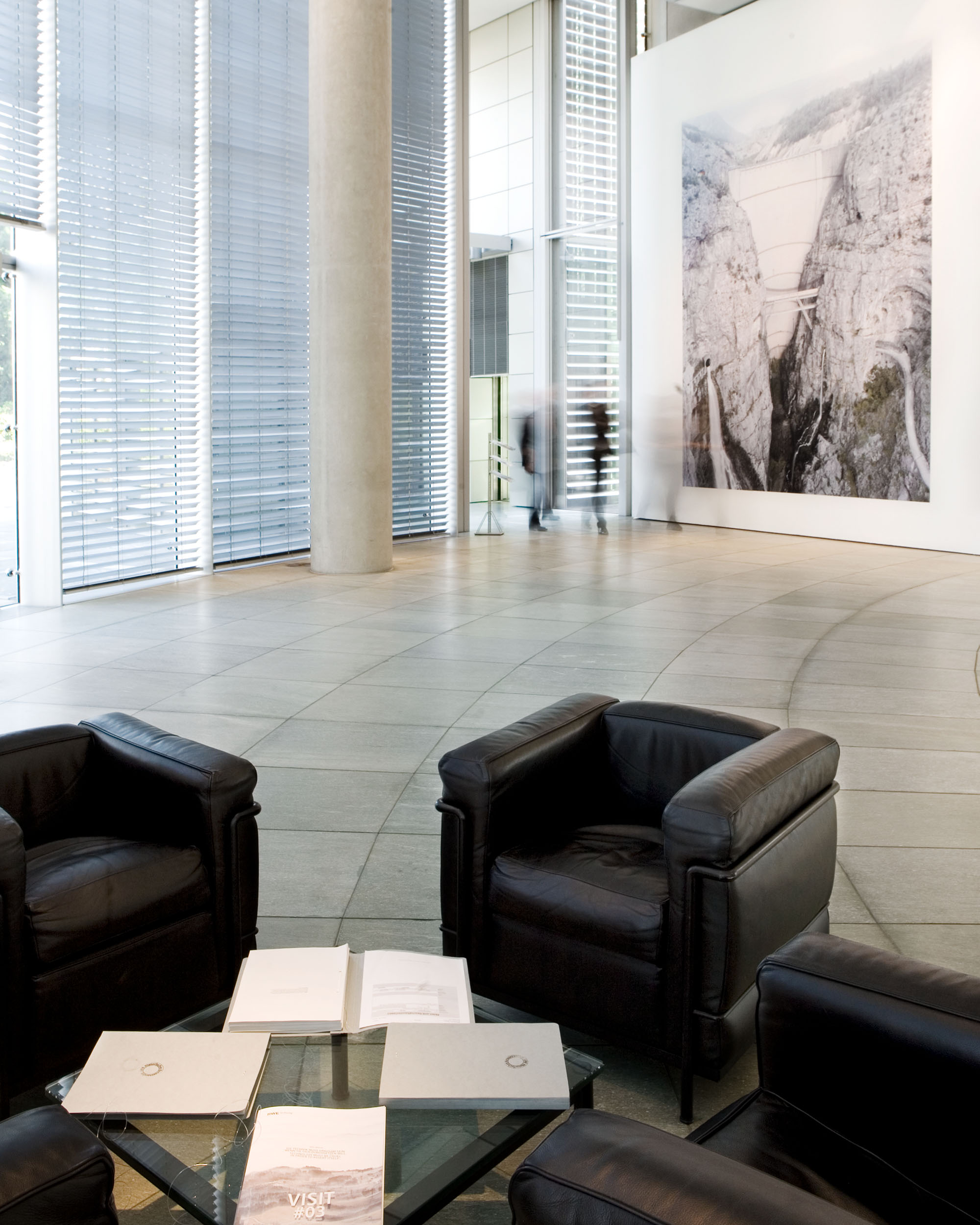
RESEARCH FOLDERS


Quote 0
Because the essence of technology is nothing technological, essential reflection upon technology and decisive confrontation with it must happen in a realm that is, on the one hand, akin to the essence of technology and, on the other, fundamentally different from it. Such a realm is art. But certainly only if reflection upon art for its part, does not shut its eyes to the constellation of truth concerning which we are questioning. Thus questioning, we bear witness to the crisis that in our sheer preoccupation with technology we do not yet experience the coming to presence of technology, that in our sheer aesthetic-mindedness we no longer guard and preserve the coming to presence of art. Yet the more questioningly we ponder the essence of technology, the more mysterious the essence of art becomes. The closer we come to the danger, the more brightly do the ways into the saving power begin to shine and the more questioning we become. For questioning is the piety of thought.
_______________________________________
Martin Heidegger, The Question Concerning Technology and Other Essays. Translated by William Lovitt. (New York: Harper & Row, 1977), p 35.
SELECTED CASE STUDIES
Examples from the complex research project structured by locations.
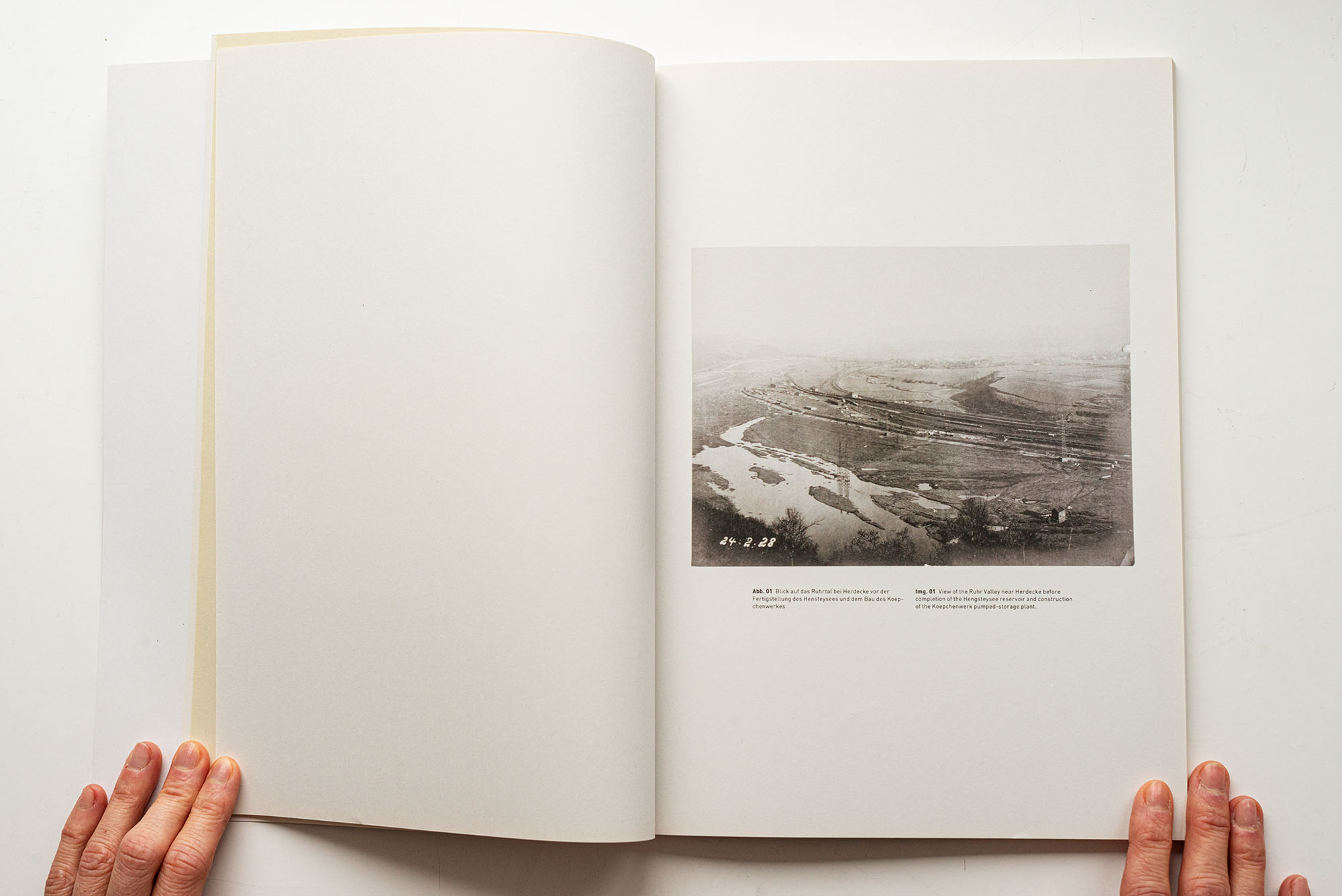
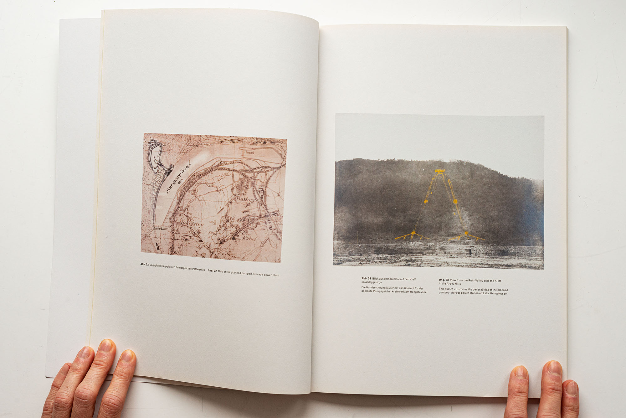
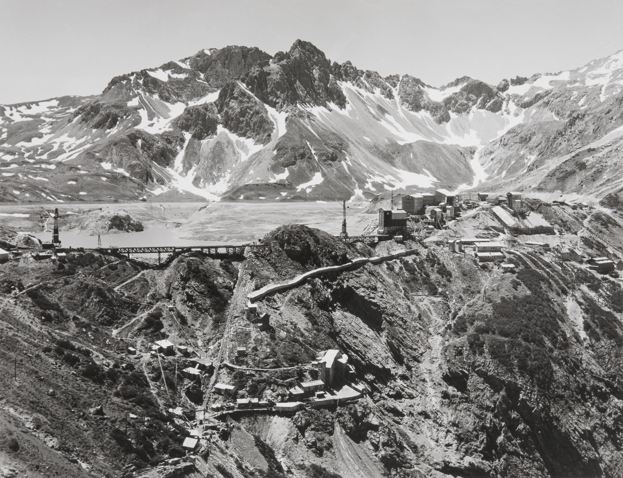
KOEPCHENWERK – HERDECKE (RUHR), GERMANY
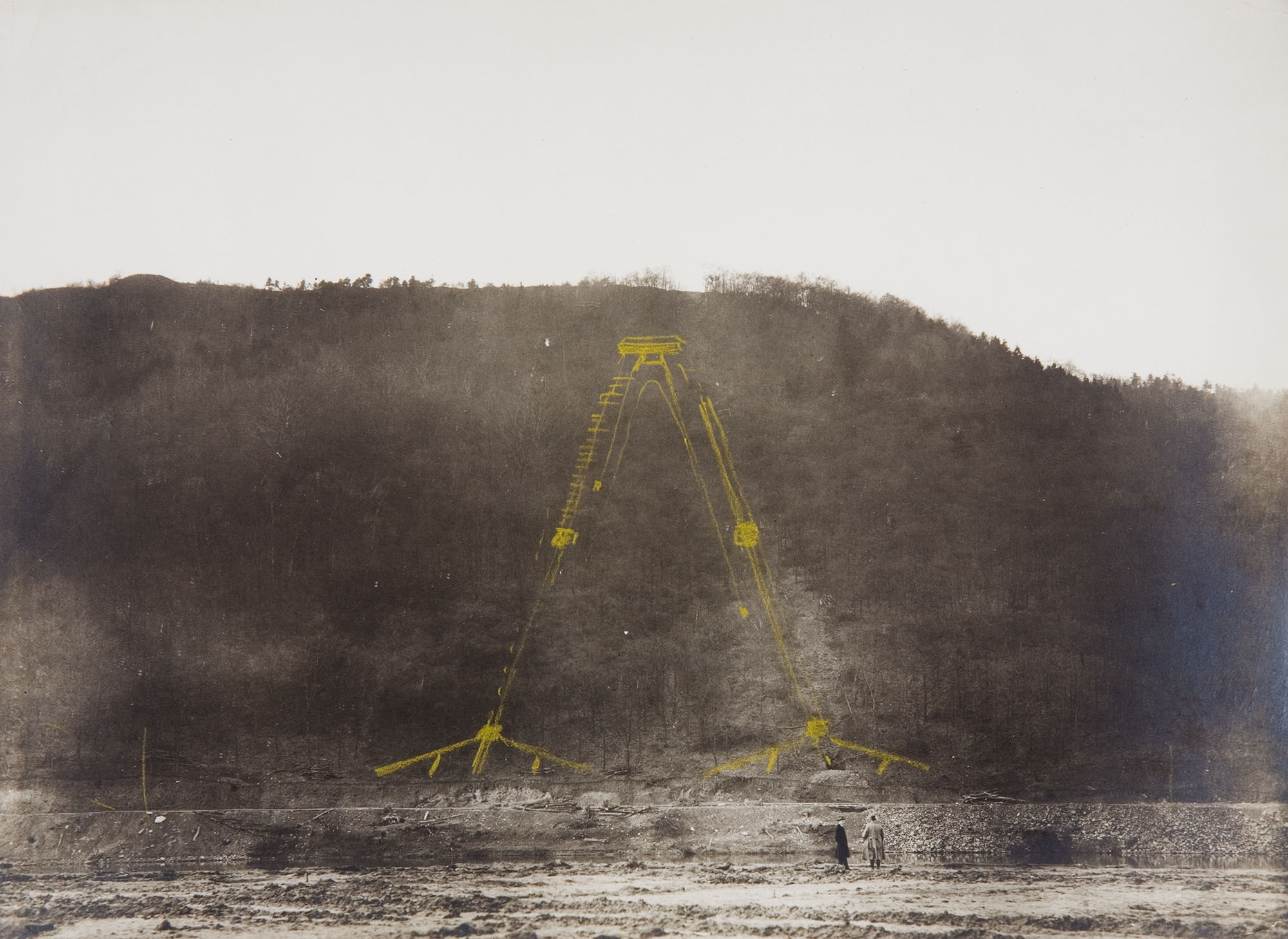
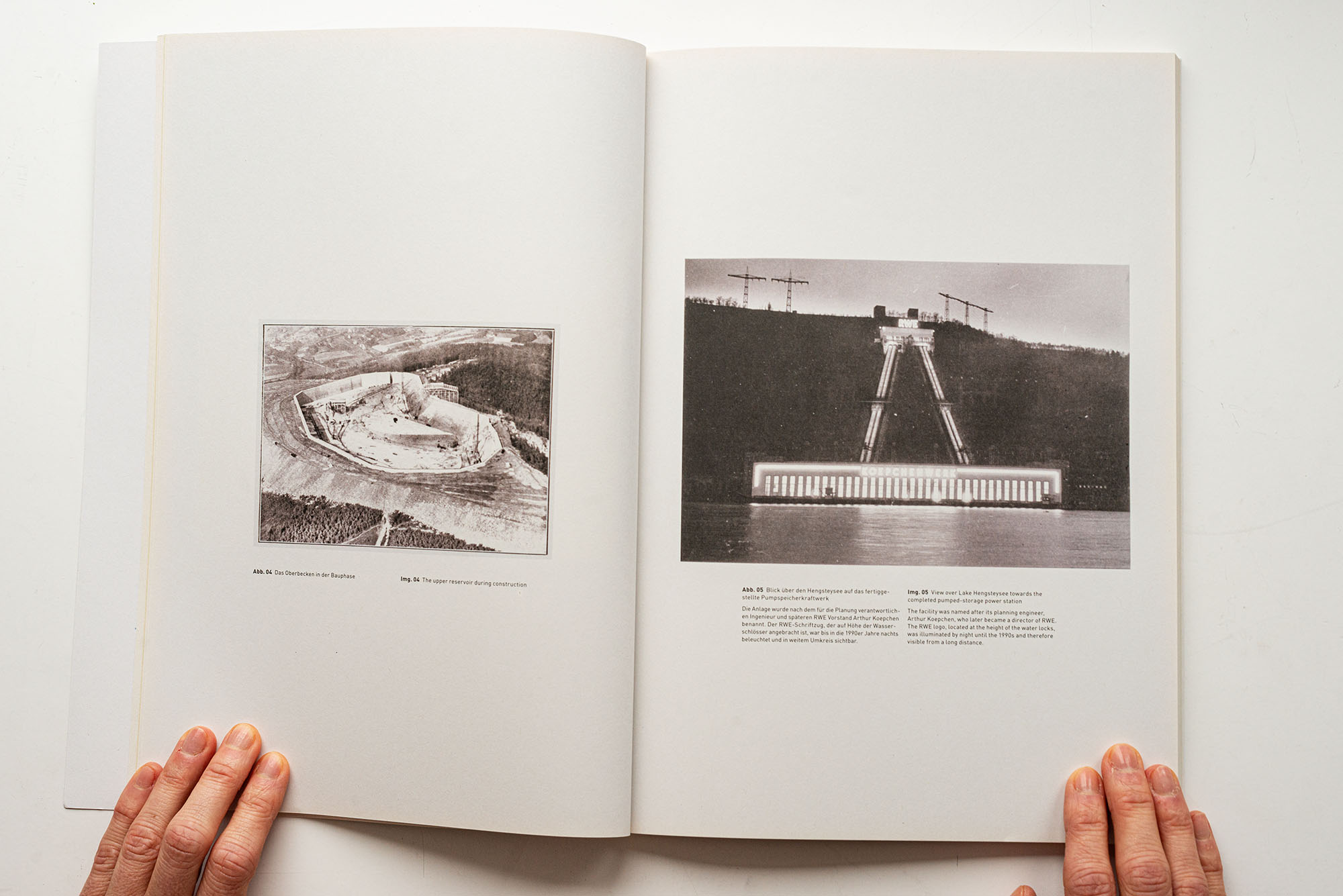
This sketch illustrates the general idea of the planned pumped-storage power station on Lake Hengsteysee.
Gelatin silver print, sketch, 24 February 1928; RWE Corporate Historical Archives
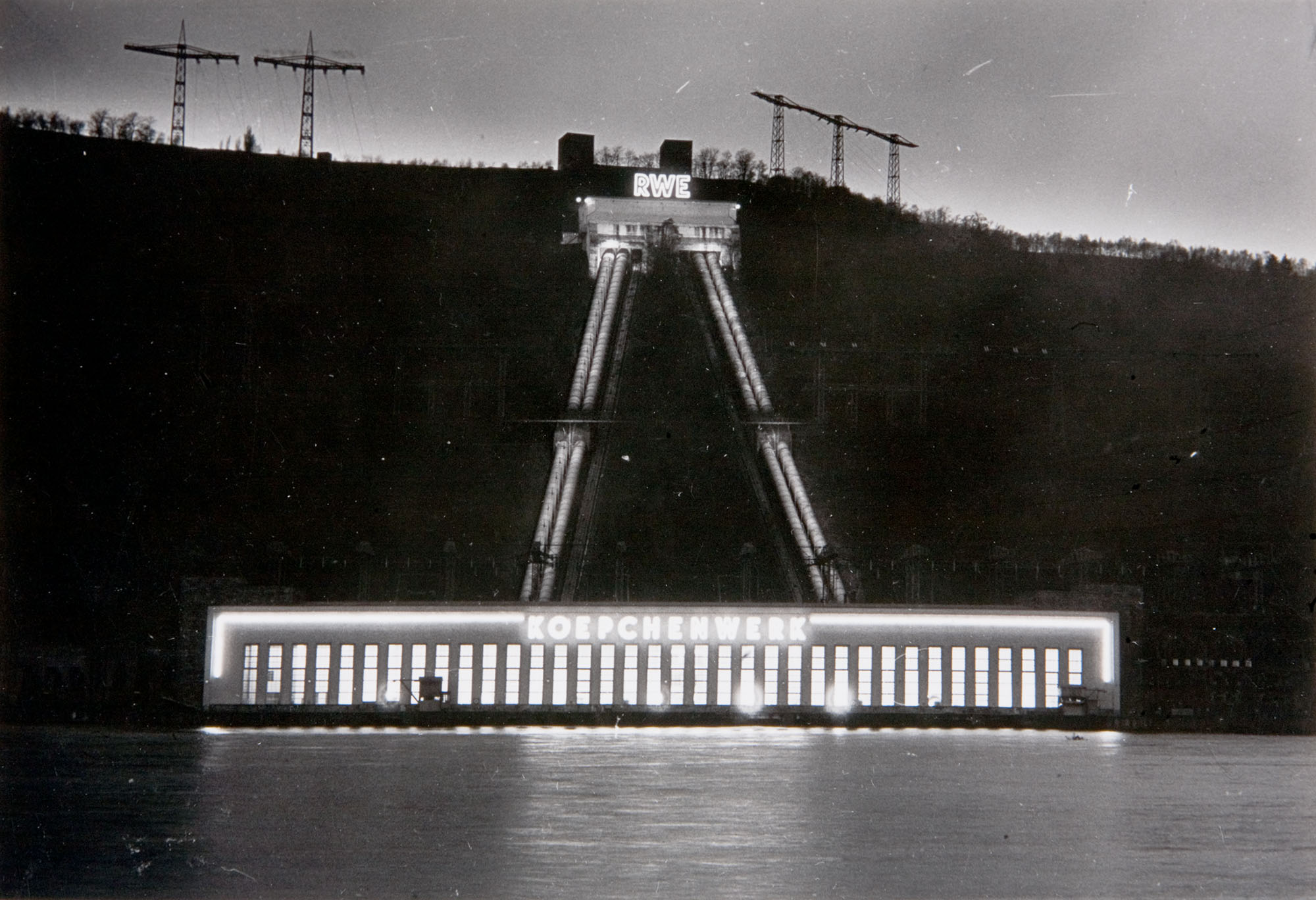
The facility was named after its planning engineer, Arthur Koepchen, who later became a director of RWE. The RWE logo, located at the height of the water locks, was illuminated by night until the 1990s and therefore visible from a long distance.
Gelatin silver print, around 1930; RWE Corporate Historical Archives
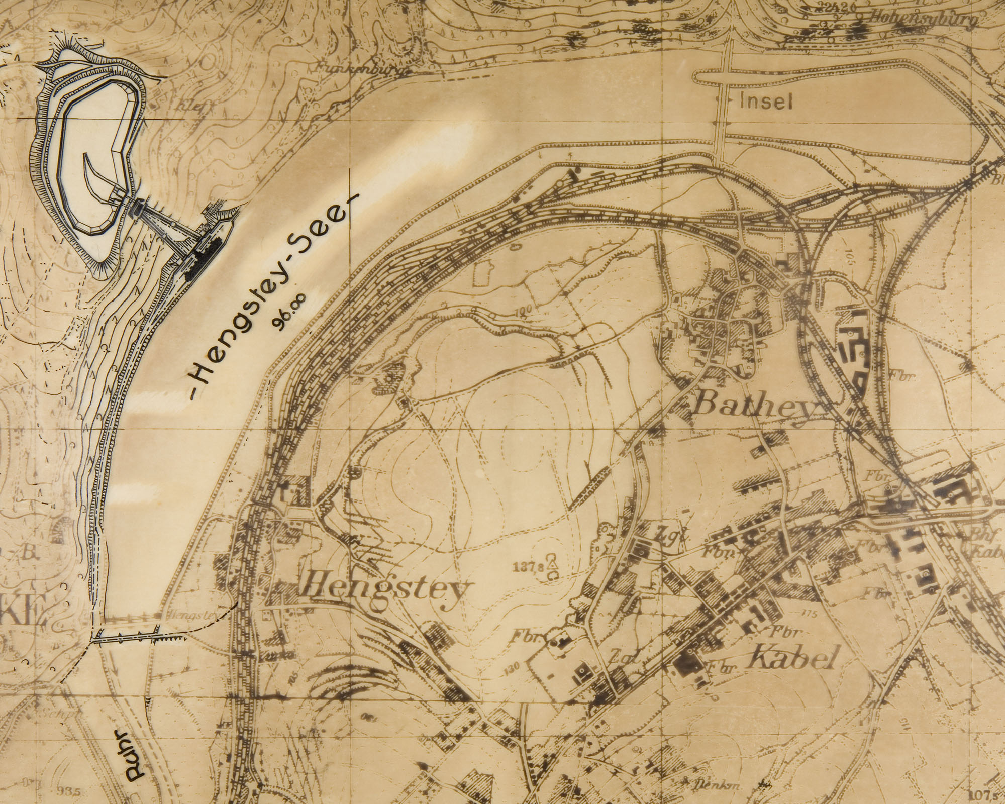
Site plan on transparent paper, sketch (detail) around 1928; RWE Corporate Historical Archives
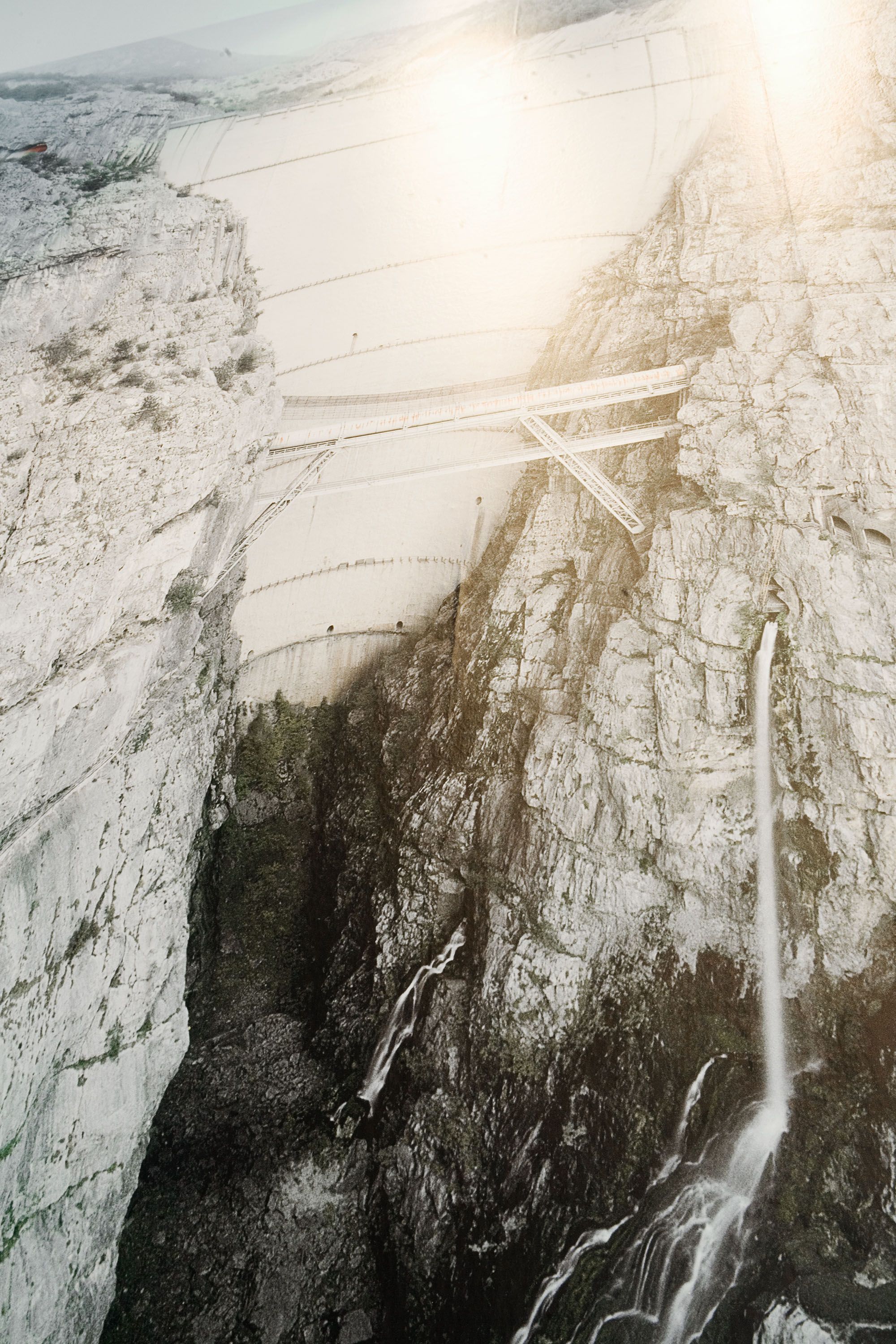
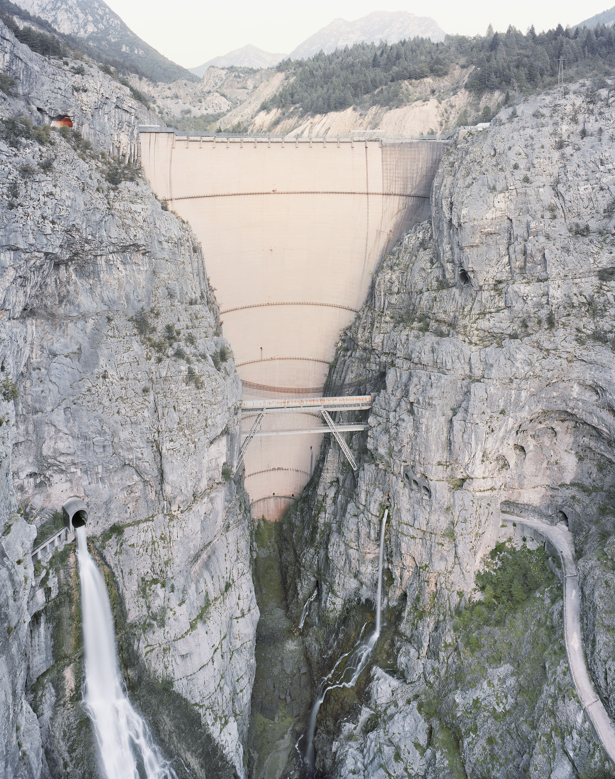
RHEINKRAFTWERK ALBBRUCK–DOGERN – GERMANY / SWITZERLAND
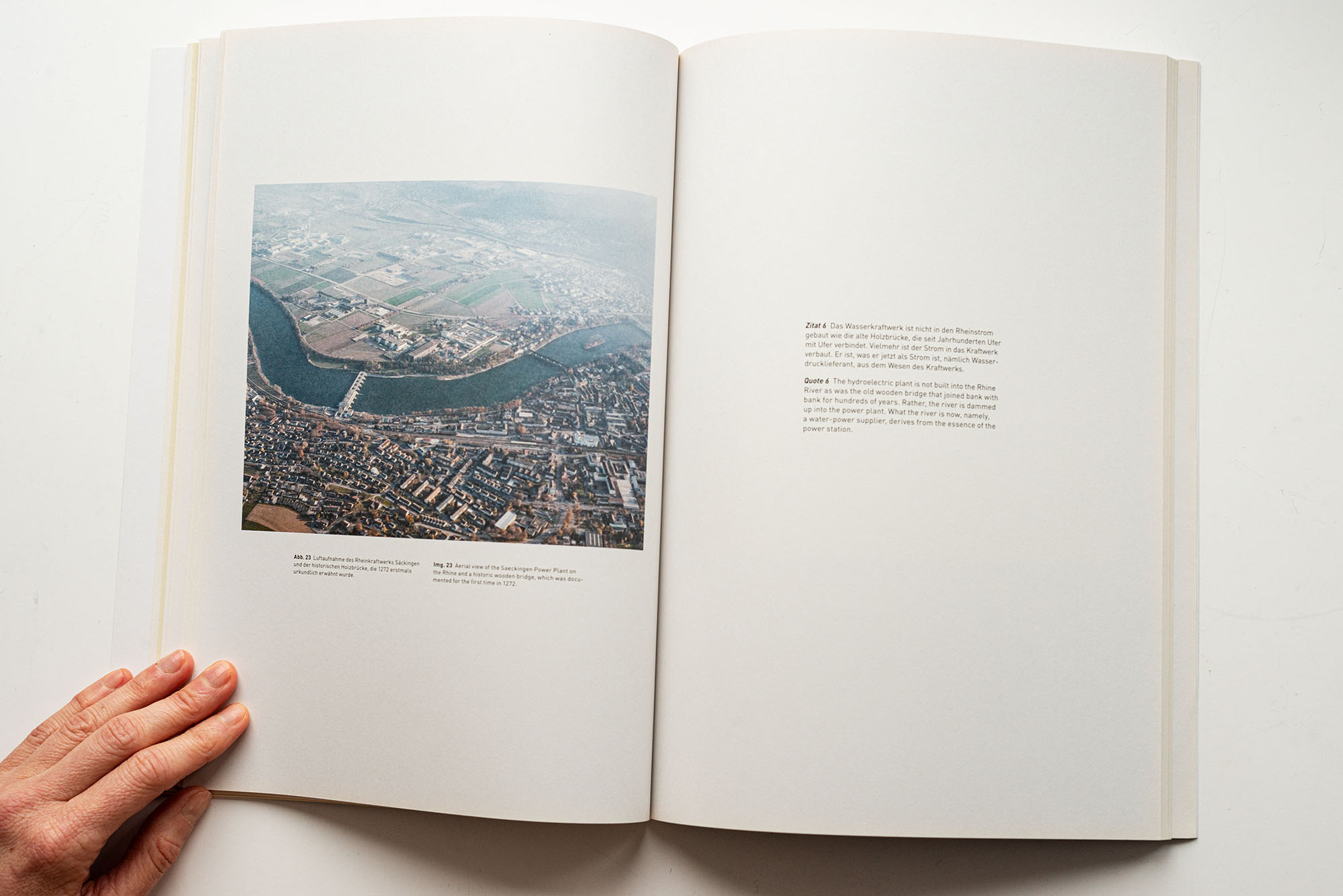
Quote 6
The hydroelectric plant is not built into the Rhine River as was the old wooden bridge that joined bank with bank for hundreds of years. Rather, the river is dammed up into the power plant. What the river is now, namely, a water-power supplier, derives from the essence of the power station.
_______________________________________
Martin Heidegger, The Question Concerning Technology and Other Essays. Translated by William Lovitt. (New York: Harper & Row, 1977), p 9.

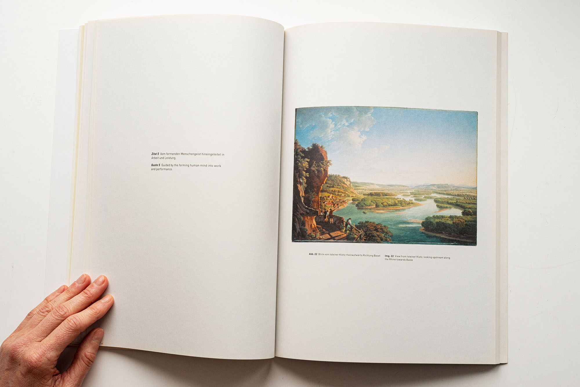
Aerial view of the Saeckingen Power Plant on the Rhine and a historic wooden bridge, which was documented for the first time in 1272


Rheinkraftwerk Albbruck-Dogern AG, Bau des Rheinkraftwerkes Albbruck-Dogern, Präsens-Film A.G. Zürich, 1930s; RWE Corporate Historical Archives

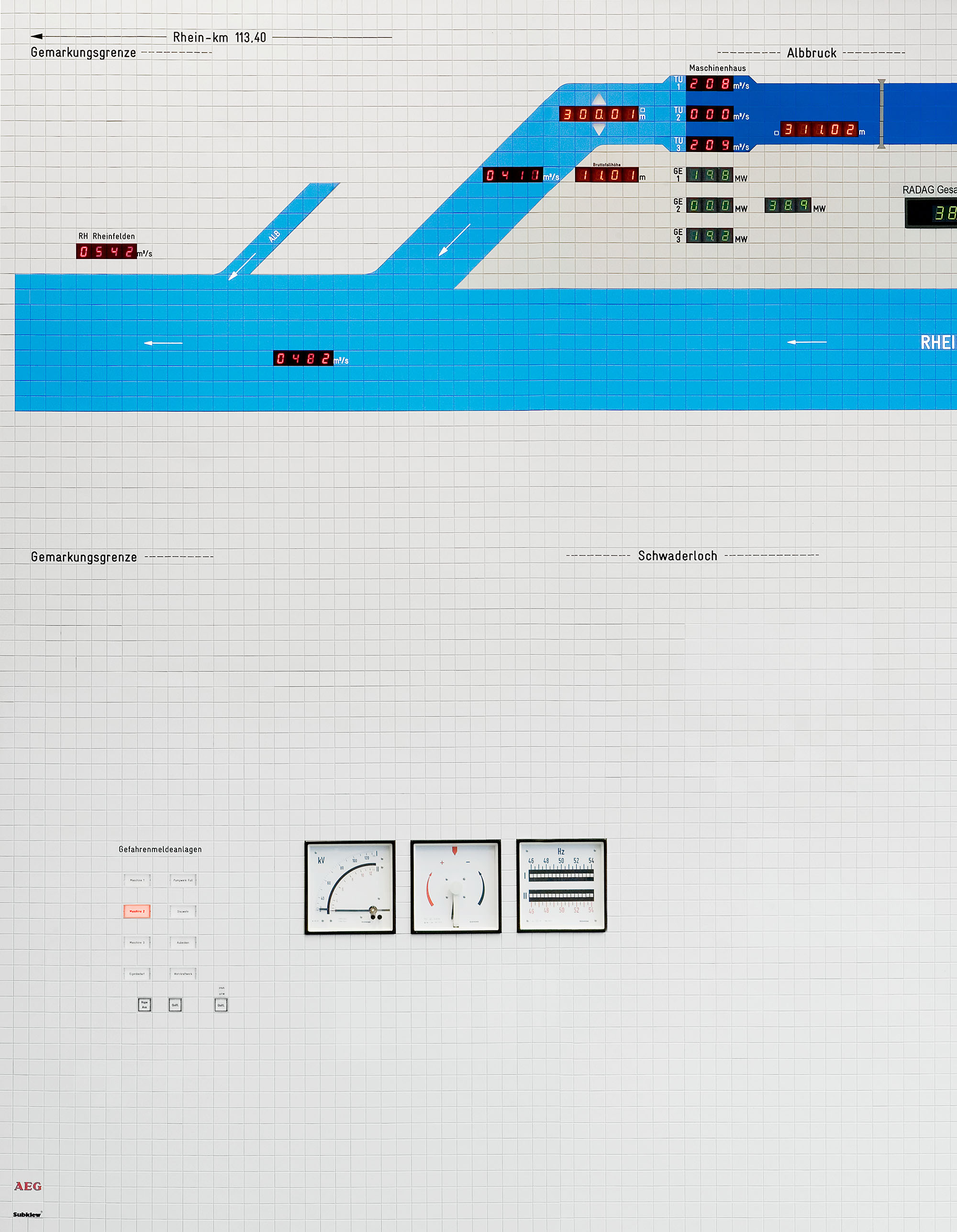
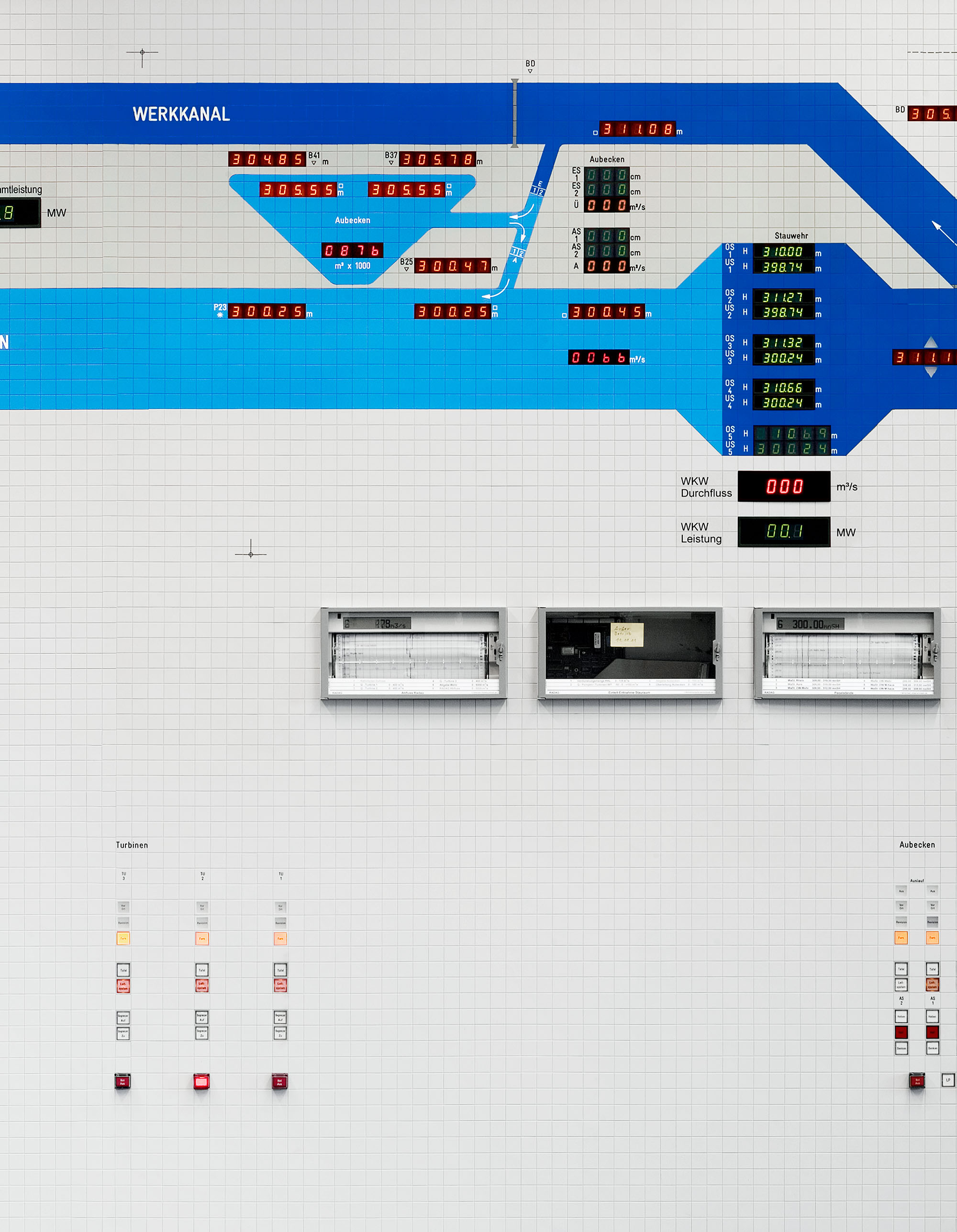
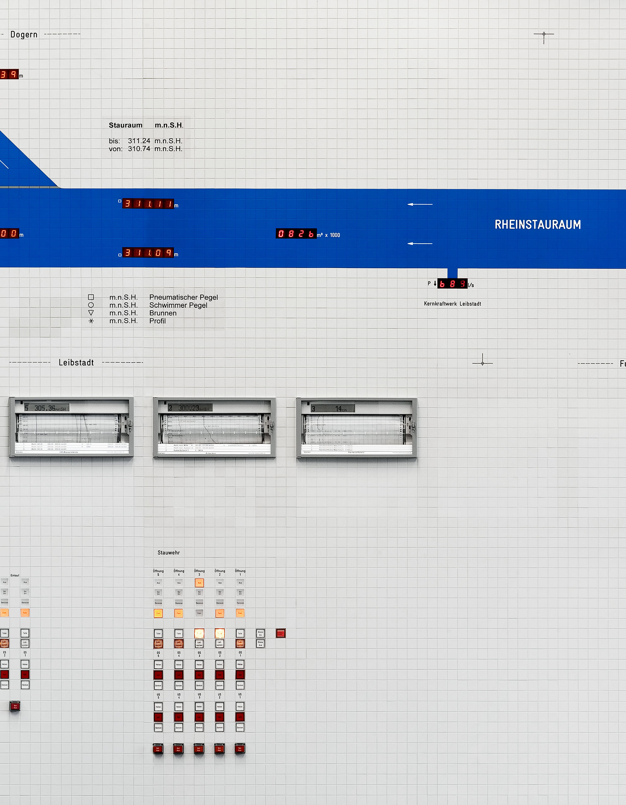
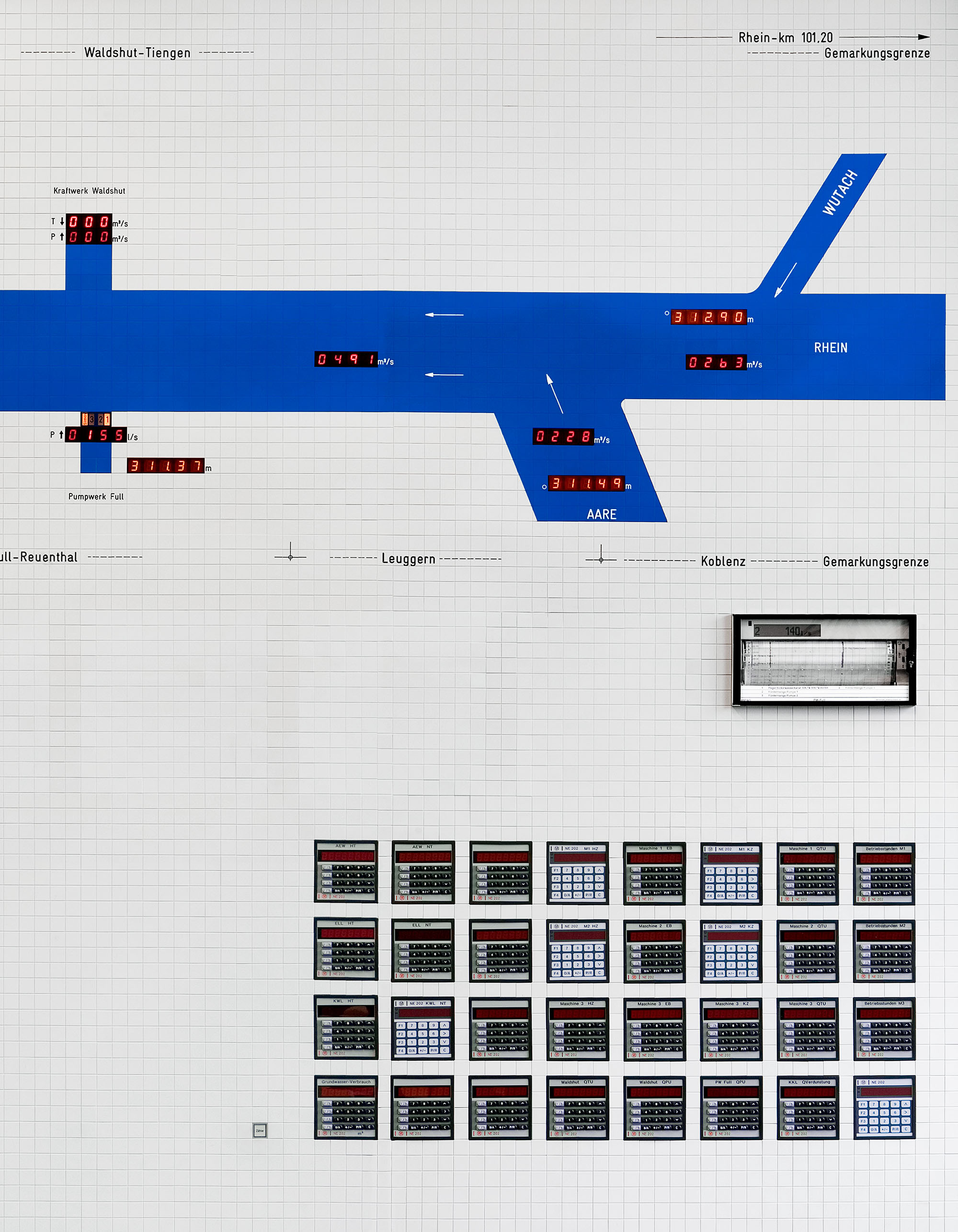
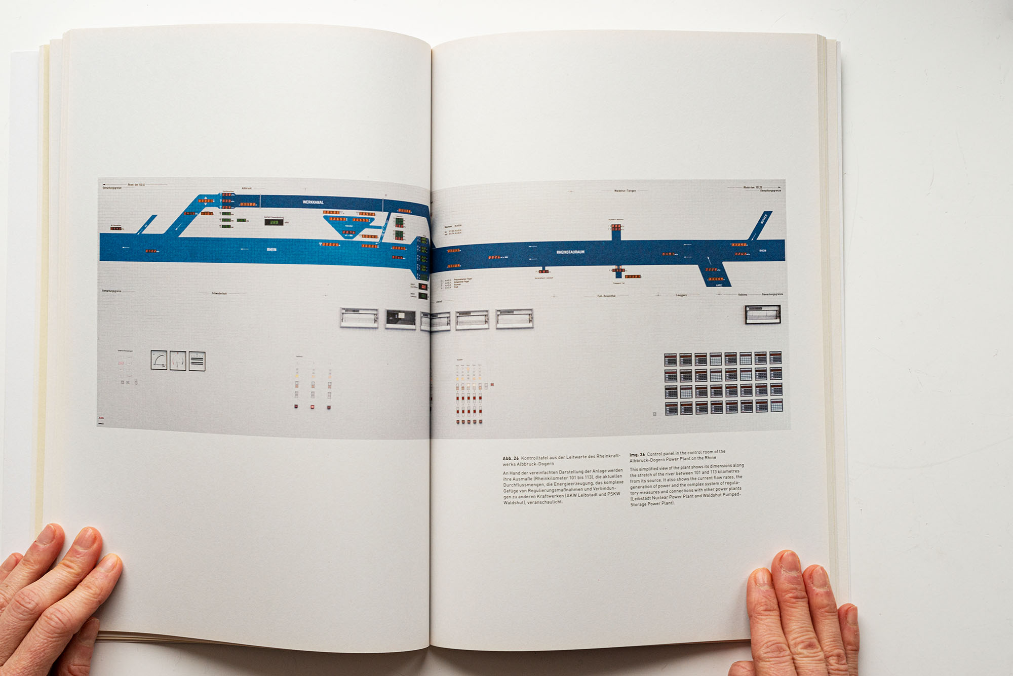
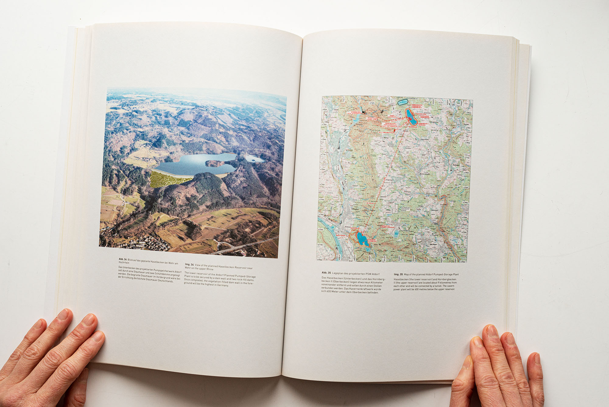
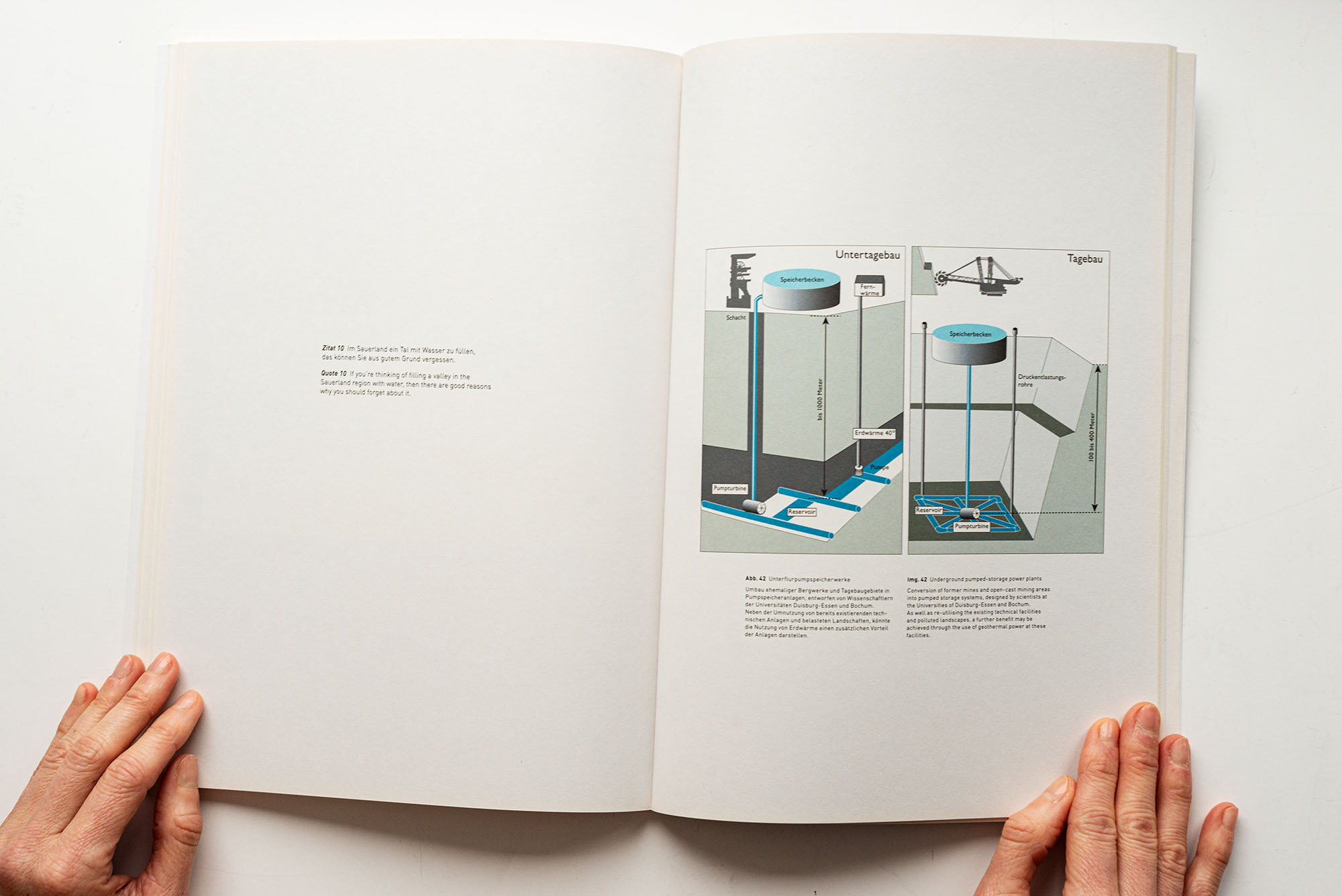
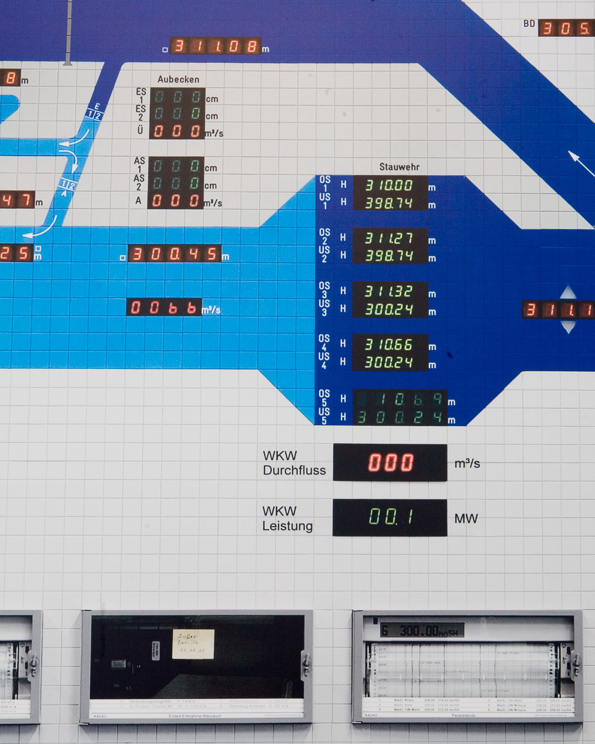
This simplified view of the plant shows its dimensions along the stretch of the river between 101 and 113 kilometres from its source. It also shows the current flow rates, the generation of power and the complex system of regulatory measures and connections with other power plants (Leibstadt Nuclear Power Plant and Waldshut Pumped-Storage Power Plant).

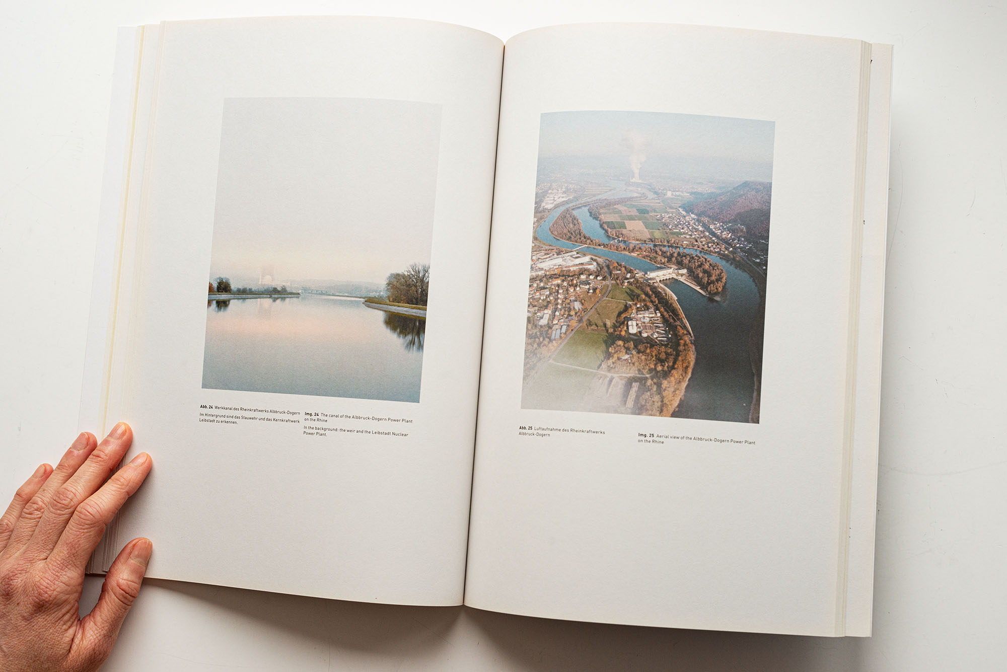
The canal of the Albbruck-Dogern Power Plant on the RhineIn the background: the weir and the Leibstadt Nuclear Power Plant.

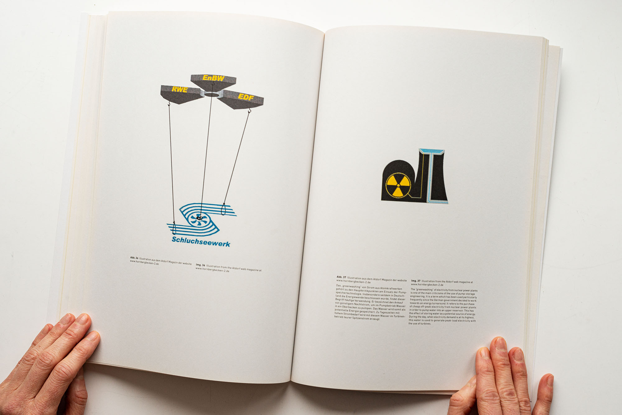
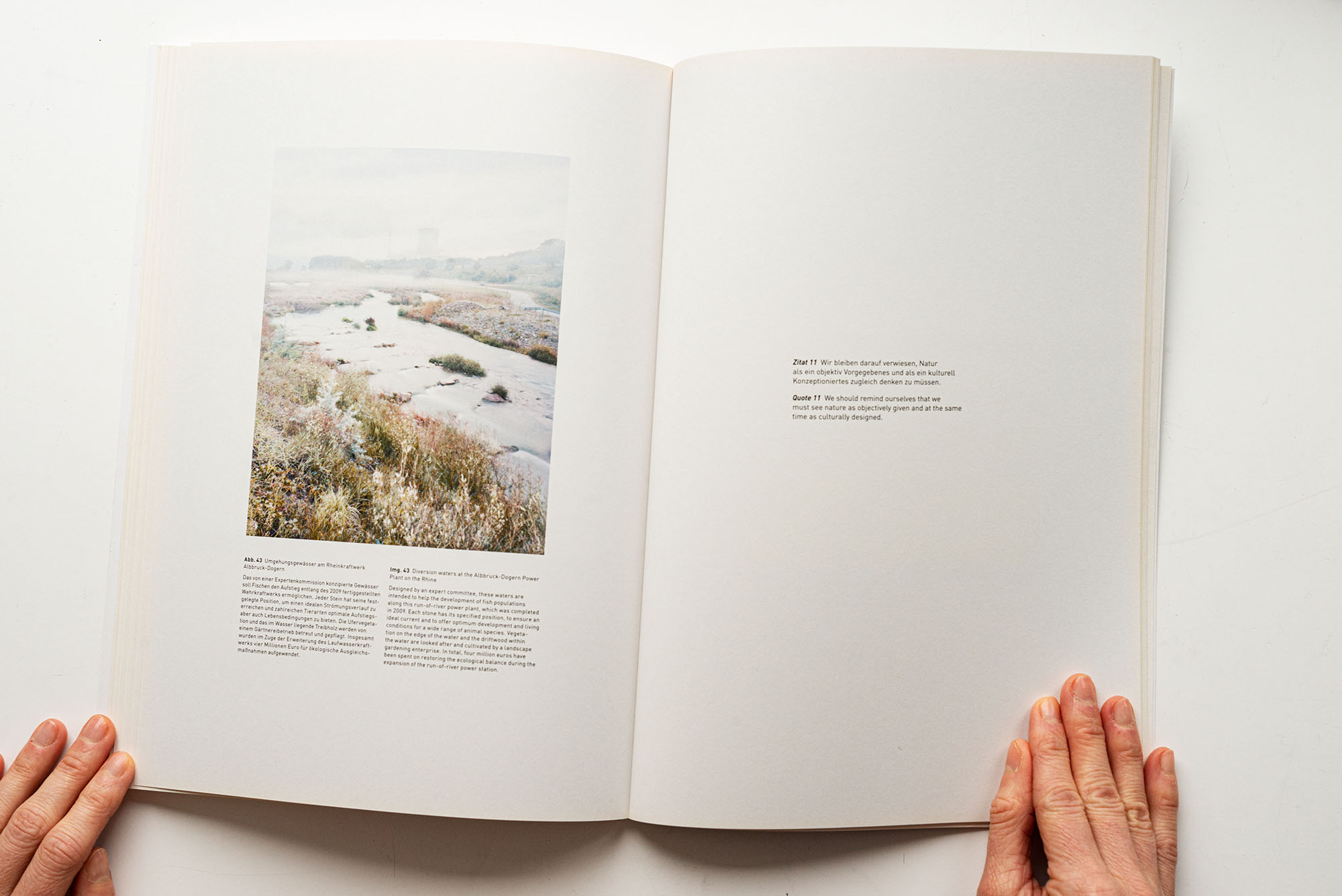
Diversion waters at the Albbruck-Dogern Power Plant on the RhineDesigned by an expert committee, these waters are intended to help the development of fish populations along this run-of-river power plant, which was completed in 2009. Each stone has its specified position, to ensure an ideal current and to offer optimum development and living conditions for a wide range of animal species. Vegetation on the edge of the water and the driftwood within the water are looked after and cultivated by a landscape gardening enterprise. In total, four million euros have been spent on restoring the ecological balance during the expansion of the run-of-river power station.
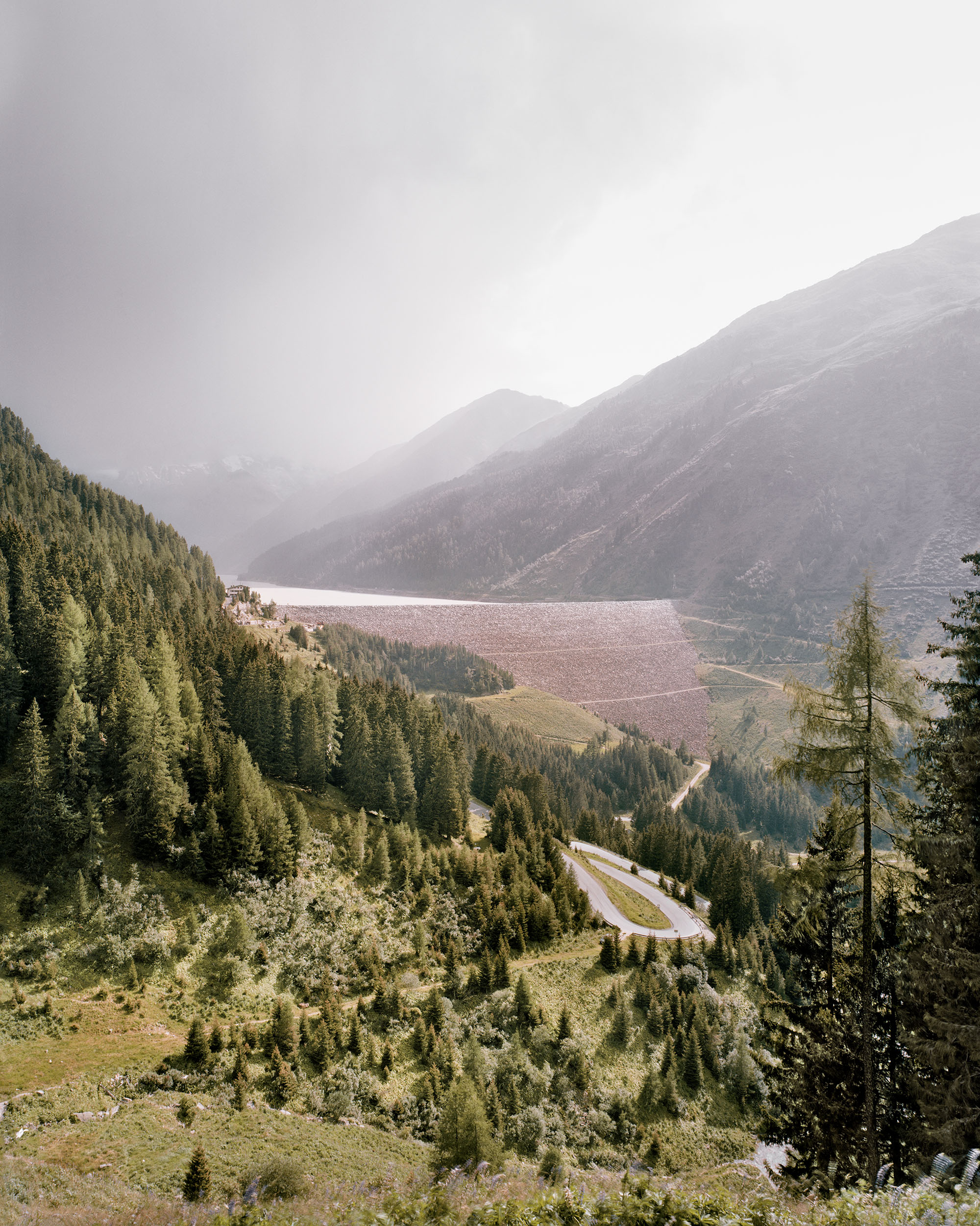
SCHLUCHSEEWERKE – BLACK FOREST, GERMANY
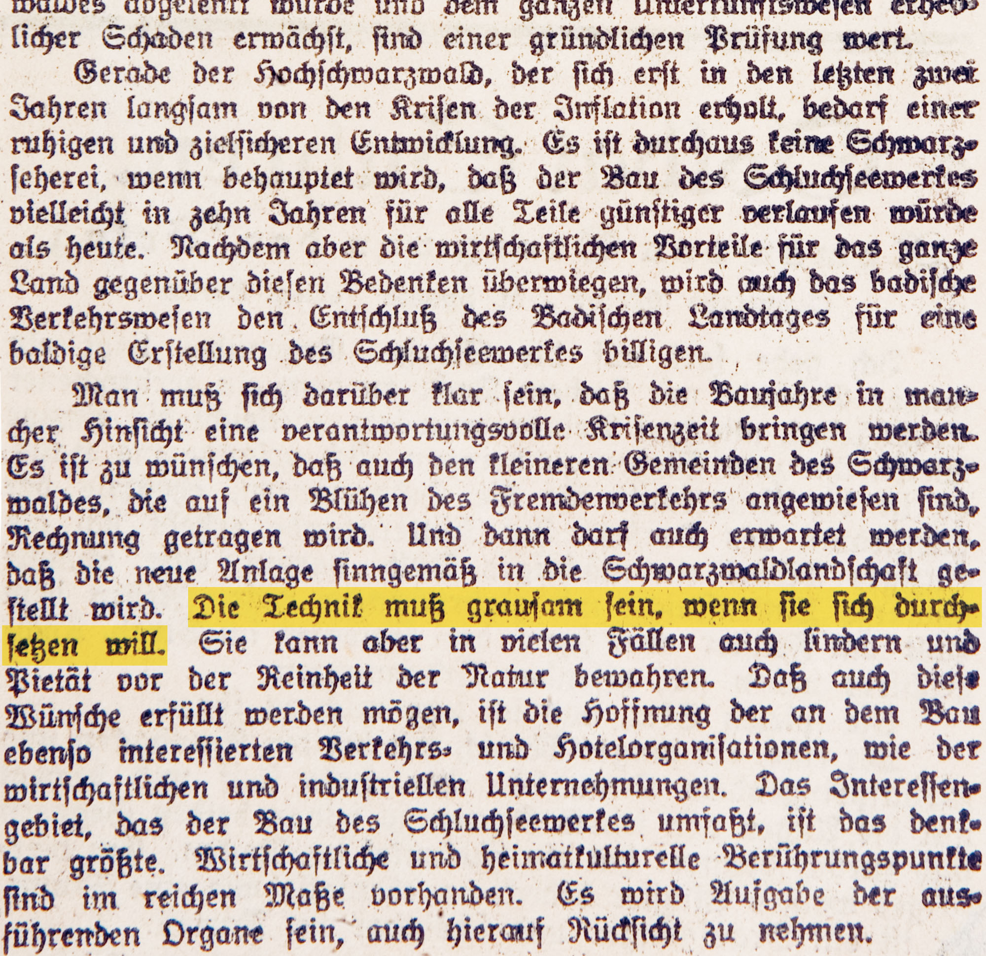
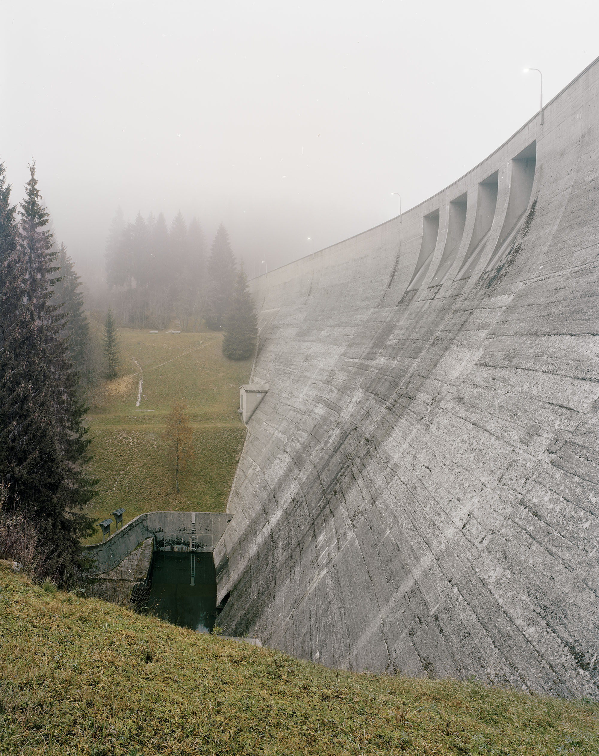
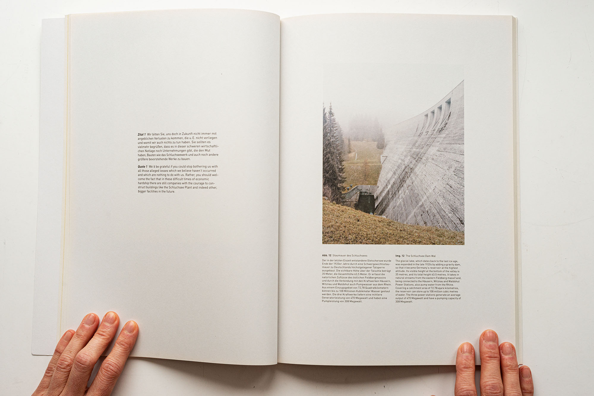
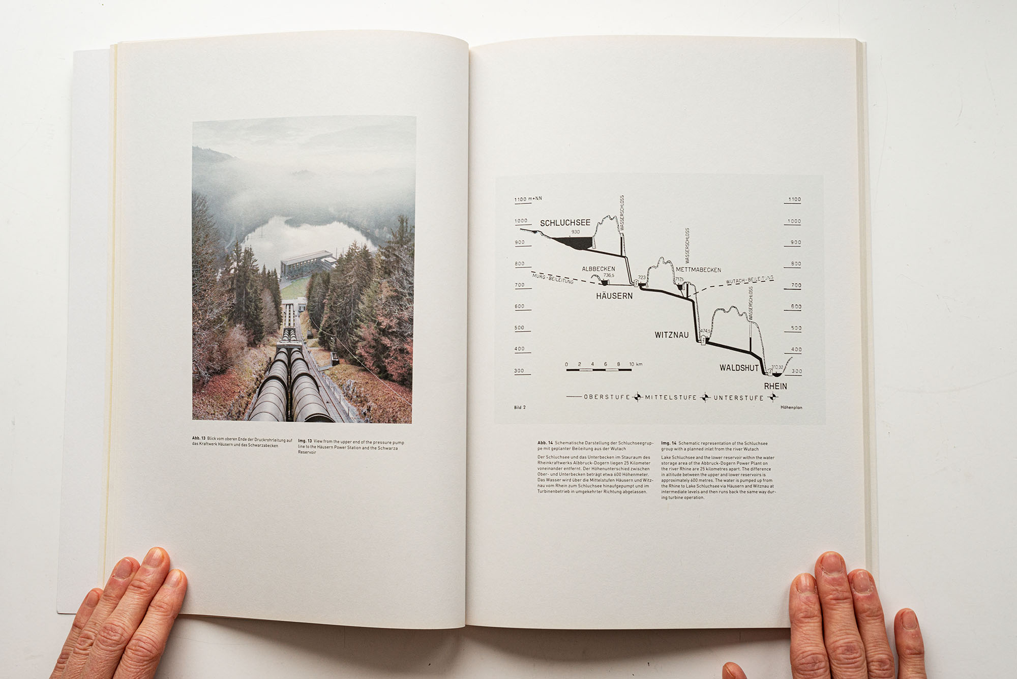
The glacial lake, which dates back to the last ice age, was expanded in the late 1920s by adding a gravity dam, so that it became Germany’s reservoir at the highest altitude. Its visible height at the bottom of the valley is 35 metres, and its total height 63.5 metres. It takes in natural streams from the eastern Feldberg massif and,being connected to the Häusern, Witznau and Waldshut Power Stations, also pump water from the Rhine. Covering a catchment area of 72.78 sqare kilometres, the reservoir can store up to 108 million cubic metres of water. The three power stations generate an average output of 470 Megawatt and have a pumping capacity of 308 Megawatt.
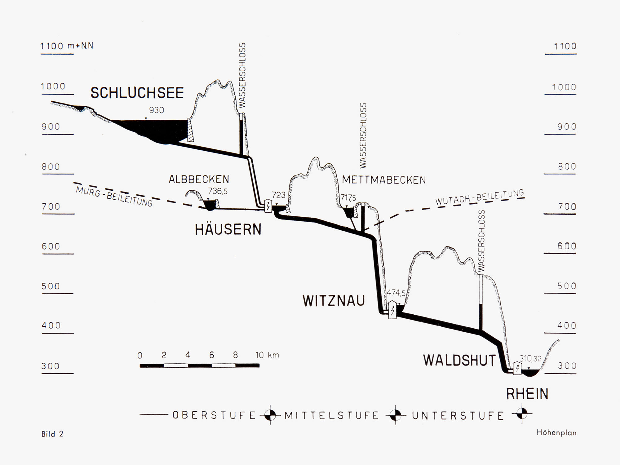
Illustration from the brochure “Schluchsee Plant”, Schluchseewerk AG, 1950; RWE Corporate Historical Archives
View from the upper end of the pressure pump line to the Häusern Power Station and the Schwarza Reservoir
Quote 2
All of us must oppose the Wutach Dam in the same way as if someone wanted to reduce Freiburg Minster to a pile of rubble. In the name of the Lord!
_______________________________________
Talk given by chief government building surveyor Schurhammer, “The Wutach Valley Nature Reserve at Risk”, Freiburg, 11 June 1951, RWE Corporate Historical Archives
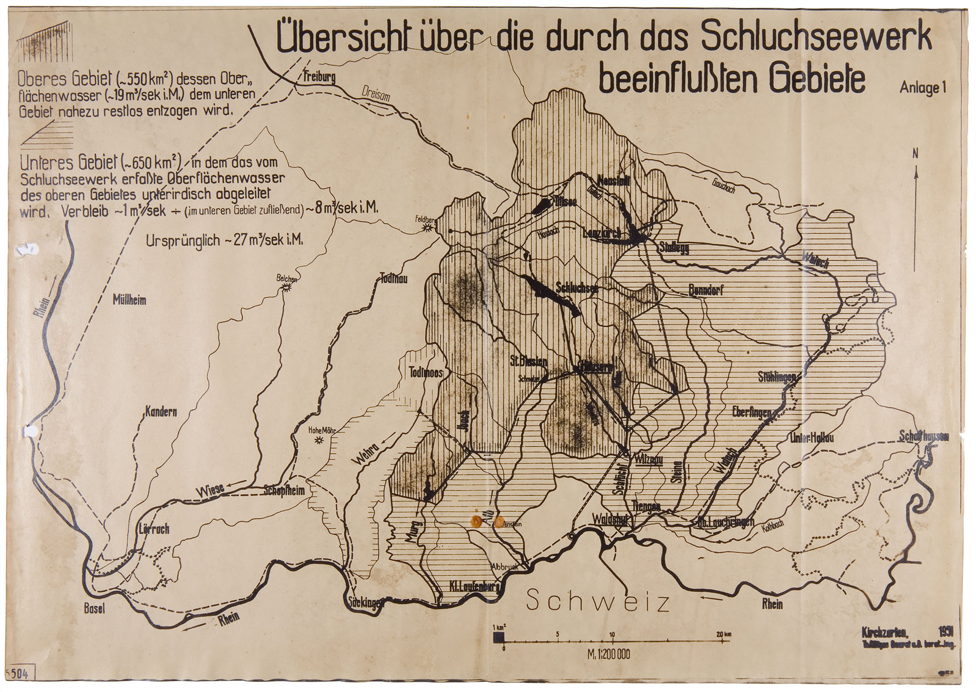
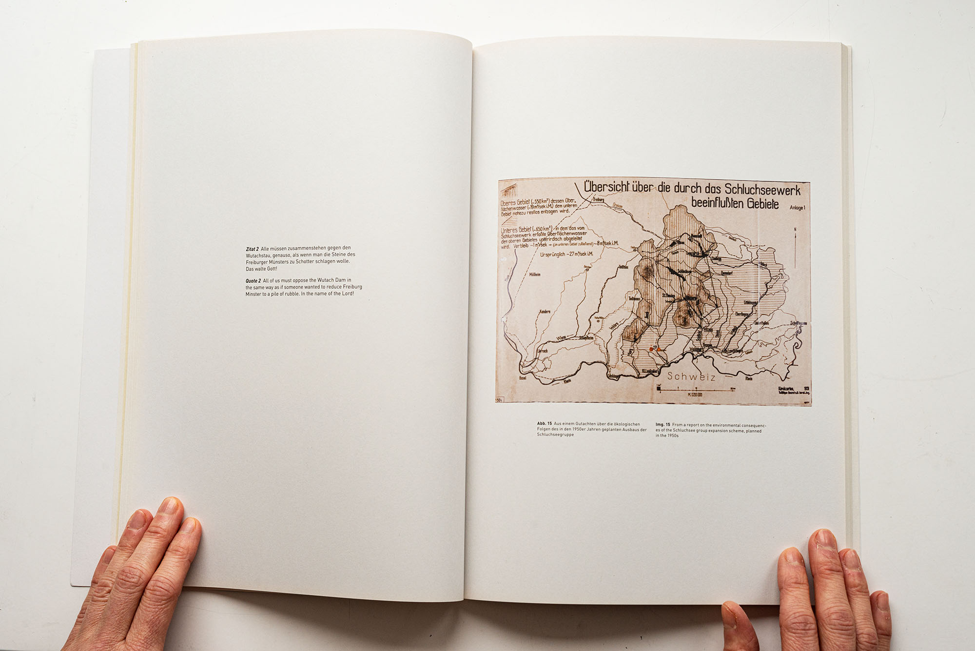
Map (1:200,000); “The Looming Drainage of the Southern Black Forest” Th. Roettges, former construction officer, 1951RWE Corporate Historical Archives
Quote 5
Guided by the forming human mind into work and performance.
_______________________________________
Schluchseewerke, Dipl. Ing. F. Bassler, Strom aus dem Schwarzwald, 1950s; RWE Corporate Historical Archives

Schluchseewerke, Dipl. Ing. F. Bassler, Strom aus dem Schwarzwald, 1950s; RWE Corporate Historical Archives
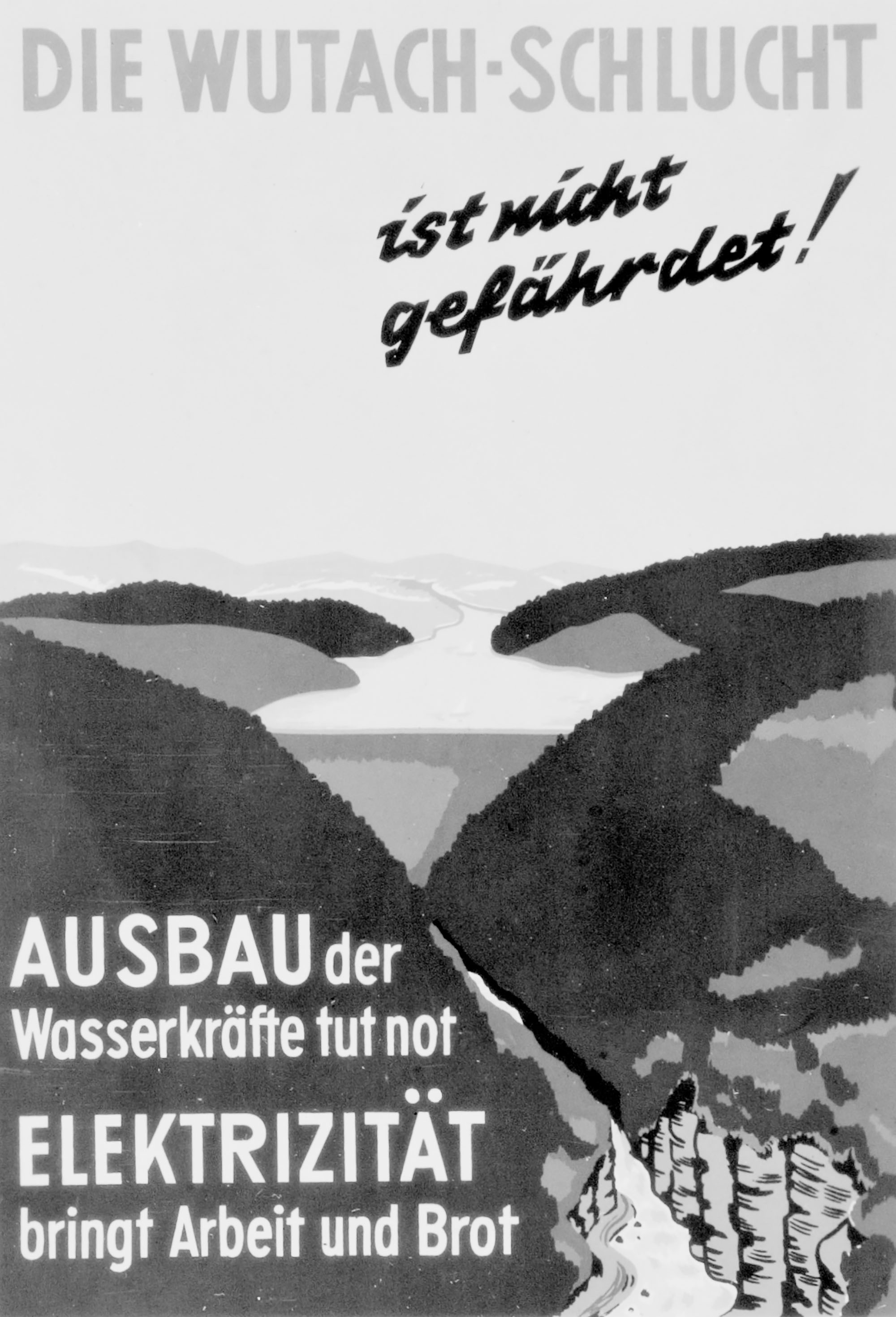
Flyer issued by the Schluchsee Power Plants in response to protests against the planned expansion of the Schluchsee group.
Schluchseewerk AG around 1951; RWE Corporate Historical Archives
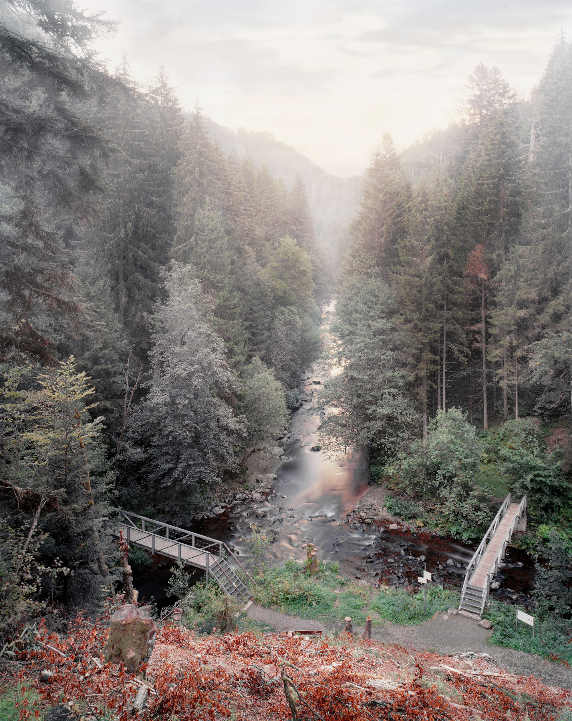
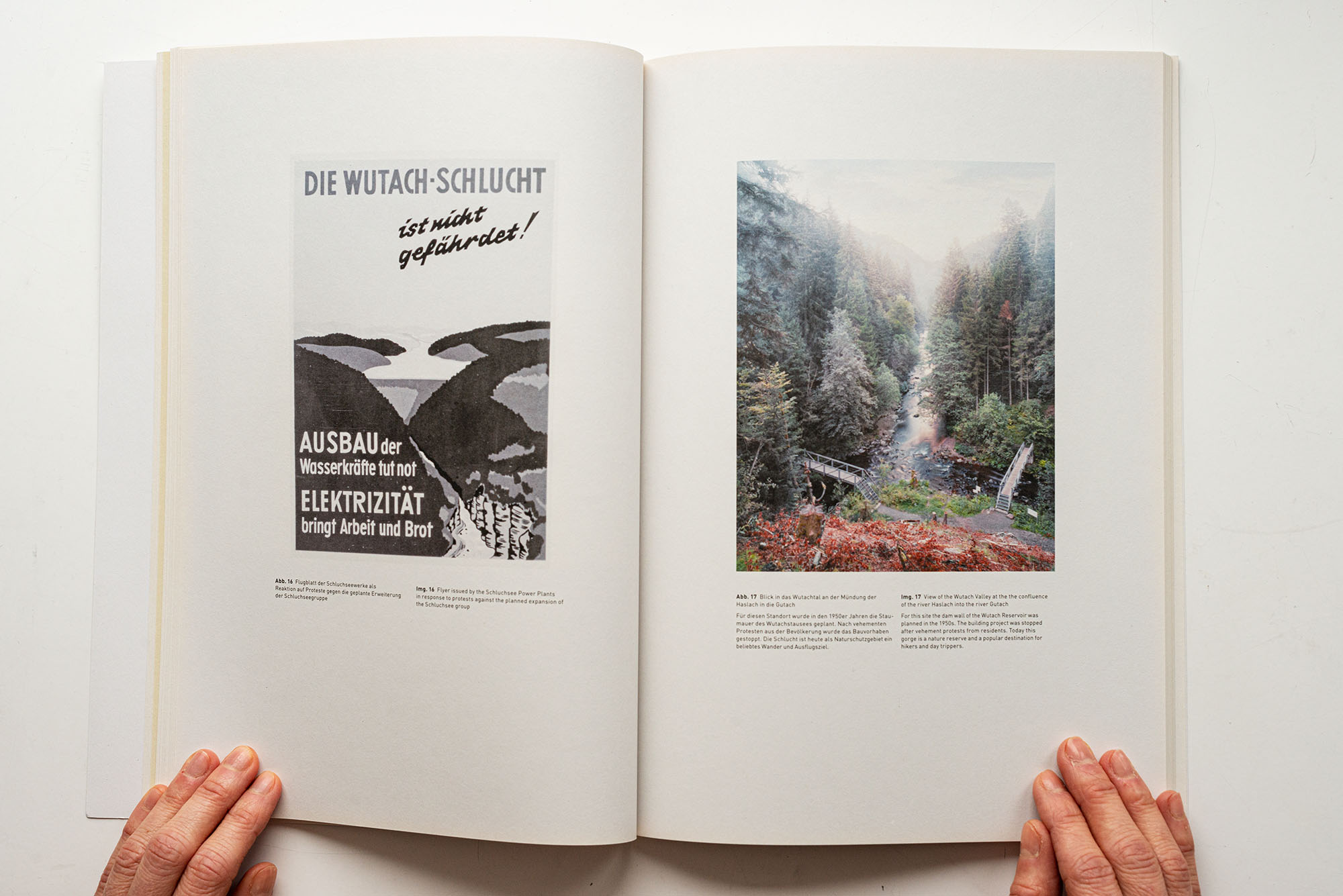
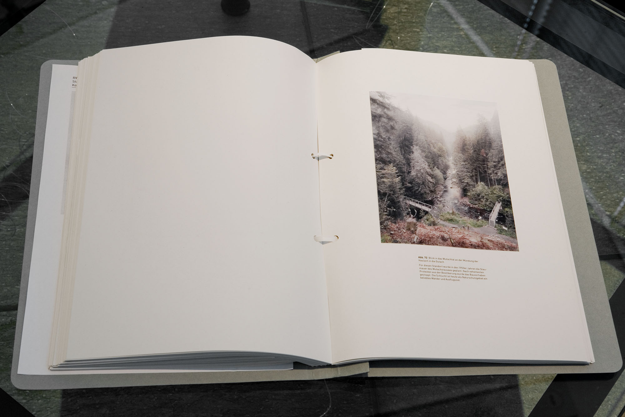
View of the Wutach Valley at the the confluence of the river Haslach into the river Gutach
For this site the dam wall of the Wutach Reservoir was planned in the 1950s. The building project was stopped after vehement protests from residents. Today this gorge is a nature reserve and a popular destination for hikers and day trippers.
PUMPED-STORAGE POWER PLANT VIANDEN, LUXEMBOURG
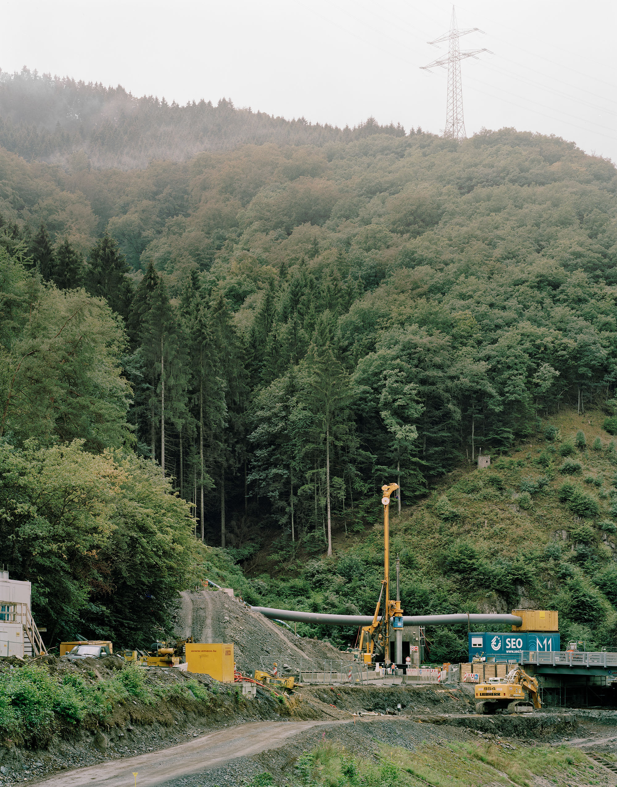
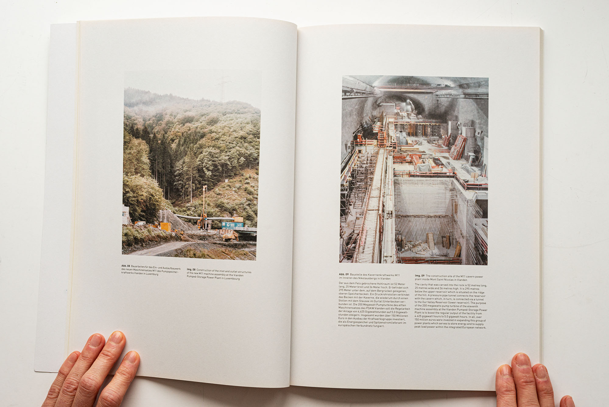
Construction of the inlet and outlet structures of the new M11 machine assembly at the Vianden Pumped-Storage Power Plant in Luxembourg
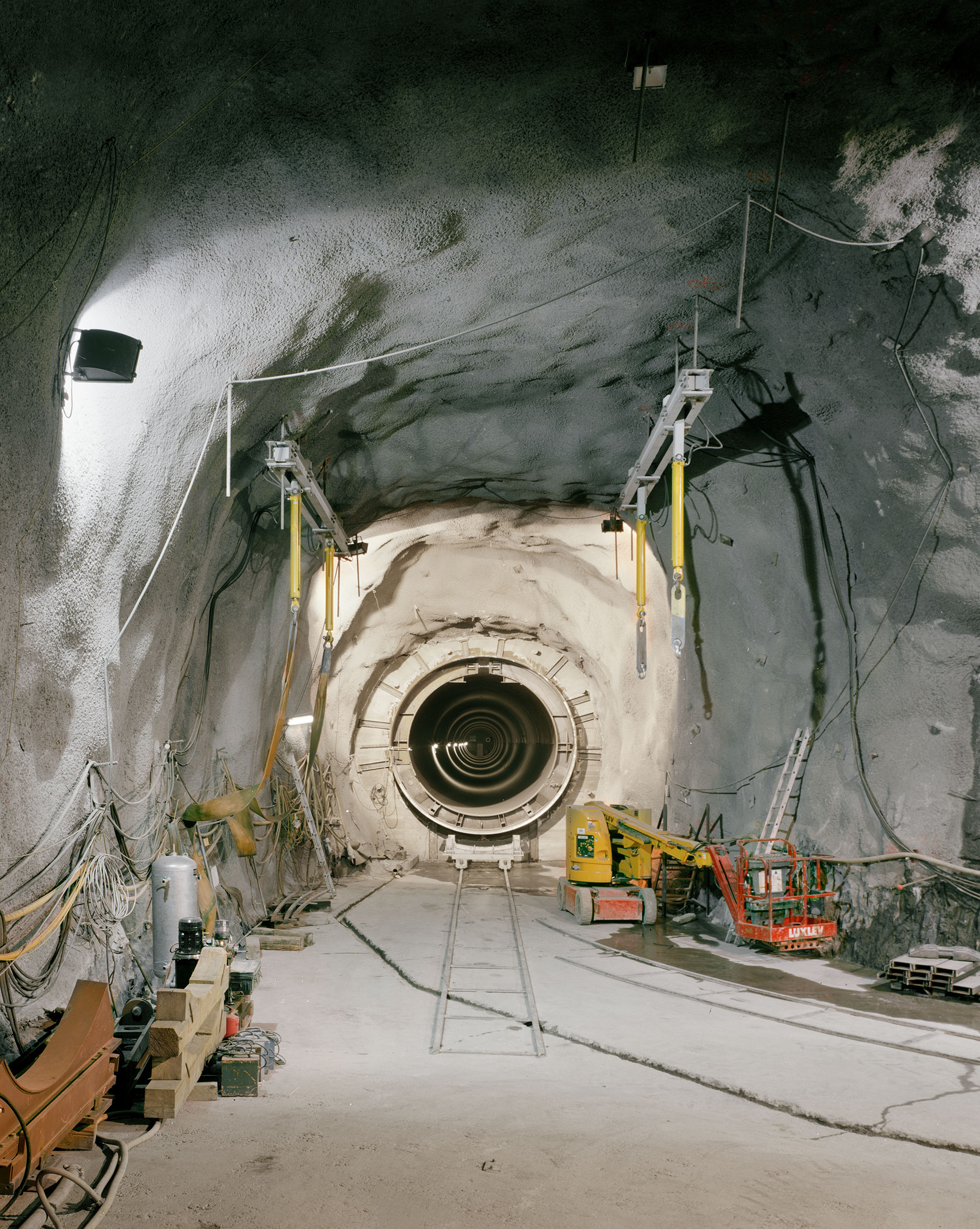
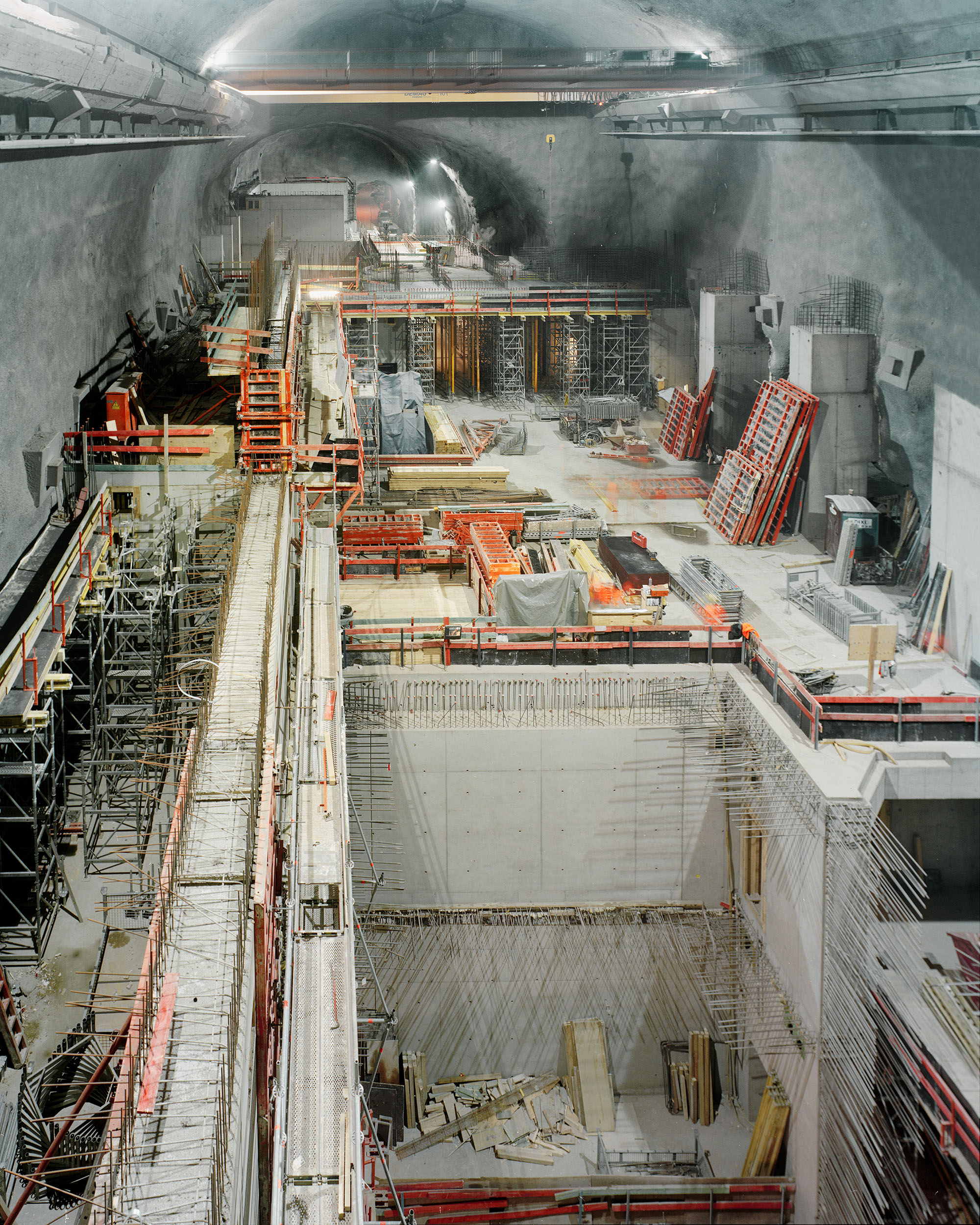
The construction site of the M11 cavern power plant inside Mont Saint Nicolas in ViandenThe cavity that was carved into the rock is 52 metres long, 25 metres wide and 36 metres high. It is 295 metres below the upper reservoir which is situated on the ridgeof the hill. A pressure pipe tunnel connects the reservoir with the cavern which, in turn, is connected via a tunnel to the Our Valley Reservoir (lower reservoir). The purpose of the 200 megawatts pump turbine of the eleventh machine assembly at the Vianden Pumped-Storage Power Plant is to boost the regular output of the facility from4.625 gigawatt hours to 5.0 gigawatt hours. In all, over 150 million euros were invested in expanding this group of power plants which serves to store energy and to supply peak load power within the integrated European network.
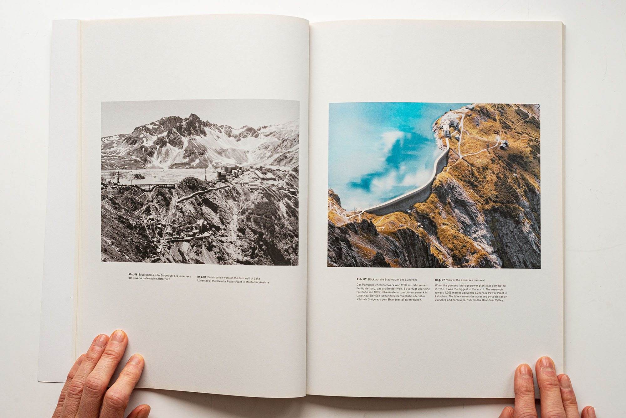
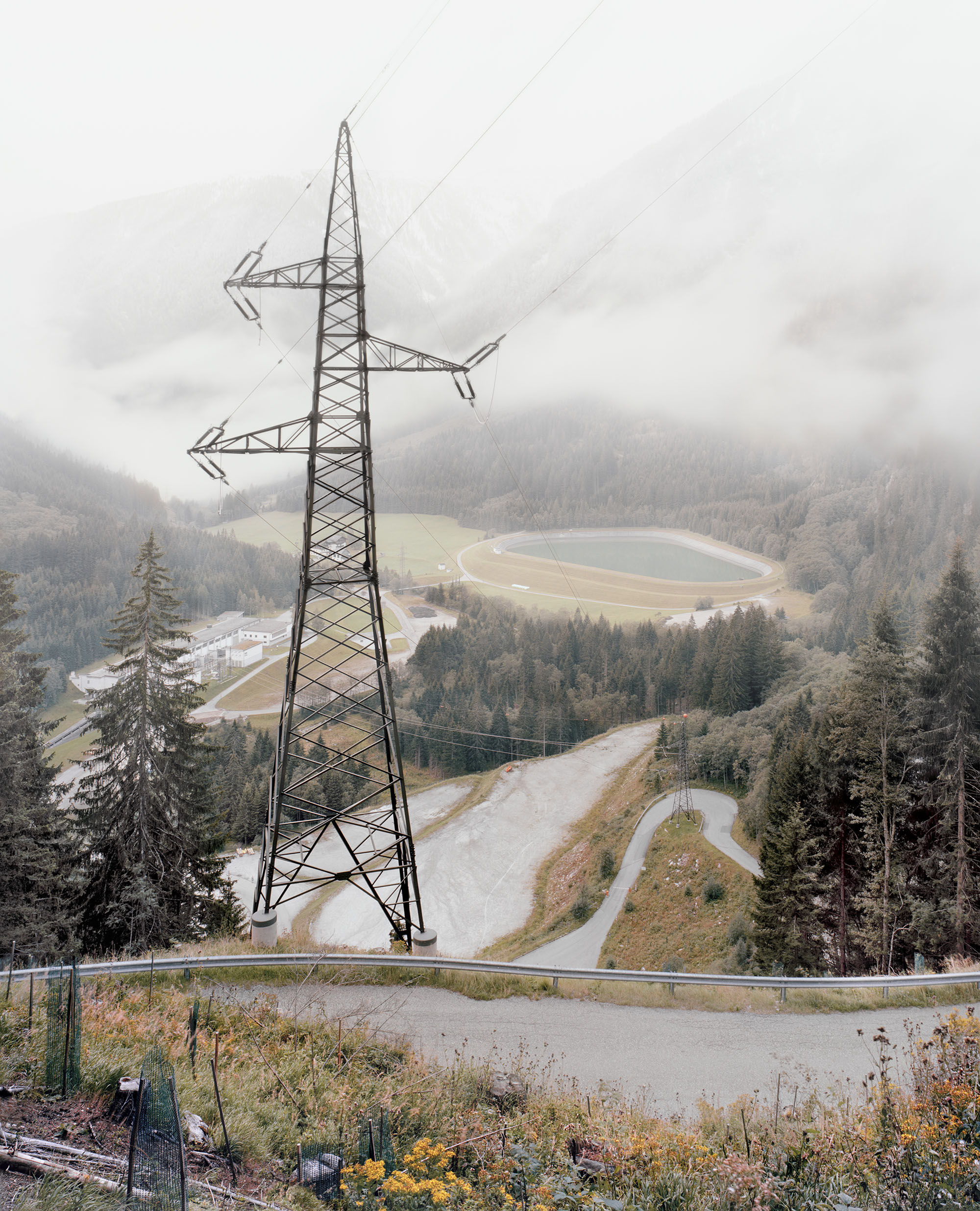
VORARLBERGER ILLWERKE – MONTAFON & BRANDNER TAL, AUSTRIA
Gelatin silver print, Vorarlberger Illwerke Aktiengesellschaft, around 1950; RWE Corporate Historical Archives
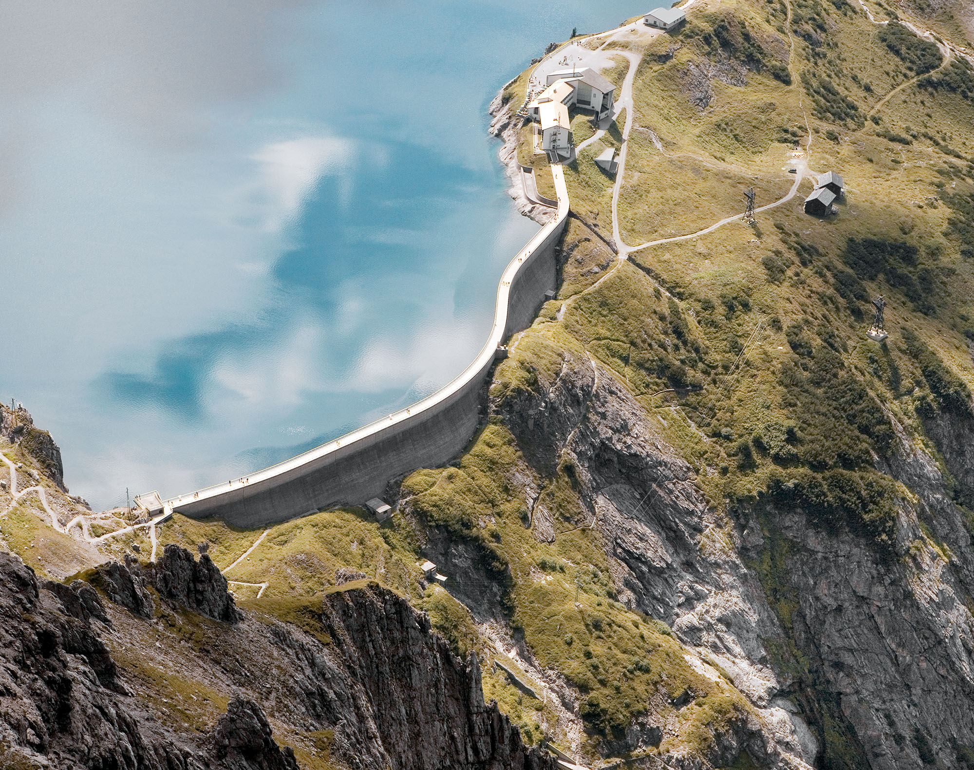
When the pumped-storage power plant was completed in 1958, it was the biggest in the world. The reservoir towers 1,005 metres above the Lünersee Power Plant in Latschau. The lake can only be accessed by cable car or via steep and narrow paths from the Brandner Valley.
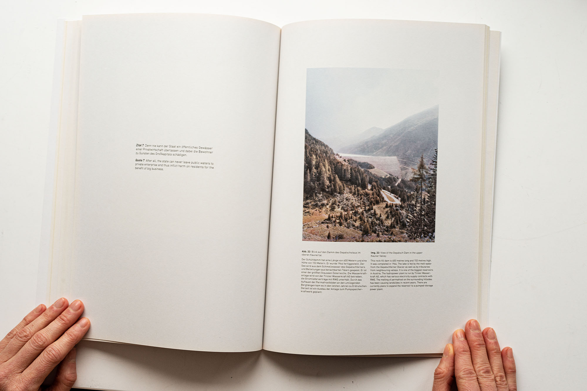
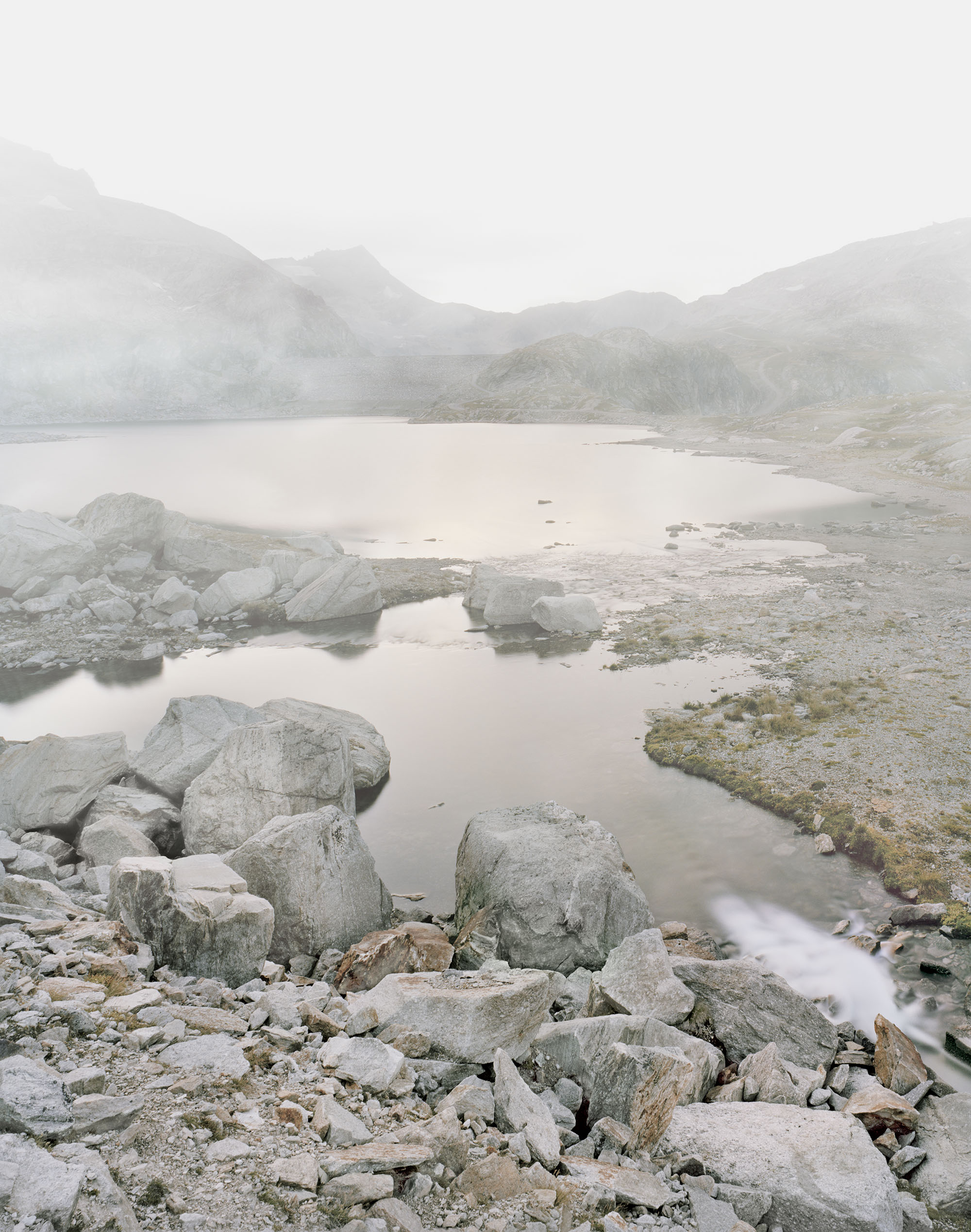
GEPATSCHSTAUSEE – KAUNERTAL, AUSTRIA
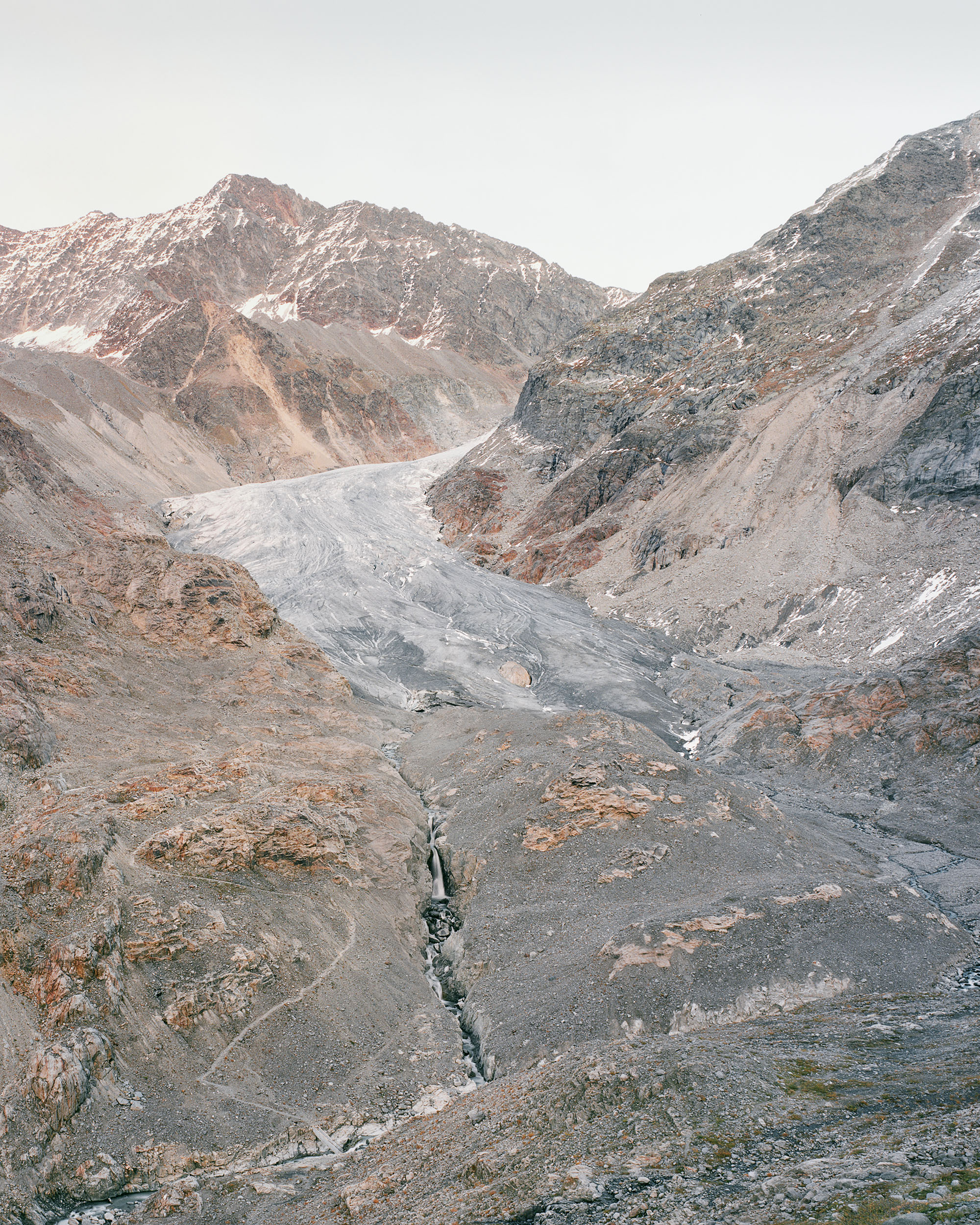
The melting water of the glacier feeds into the Gepatsch Reservoir. Since 2011, the glacier has retreated dramatically.
View of the Gepatsch Dam in the upper Kauner Valley
This rock-fill dam is 600 metres long and 153 metres high. It was completed in 1964. The lake is fed by the melt water from the Gepatschferner Glacier as well as by tributaries from neighbouring valleys. It is one of the biggest reservoirs in Austria. The hydropower plant is run by Tiroler Wasserkraft AG, which has various electricity supply contracts with RWE. The melting of permafrost on the surrounding hillsideshas been causing landslides in recent years. There are plans to expand the reservoir to a pumped-storage power plant.
Quote 4
What we in Europe view as our natural environment is actually the product of constant reshaping. It is a cultural landscape which humans have created over two millennia and constantly adapted to their needs. The human race needs nature: indeed the world‘s inexorably rising population cannot survive if it does not use the possibilities offered to it by nature.
_______________________________________
Dipl. Ing. Karl Becker, Energie aus Kohle und Wasserkraft, in: RWE und die Wasserkraft, RWE AG, Essen, 1993; p. 33
KRAFTWERKSGRUPPE FRAGANT – MÖLLTAL, AUSTRIA
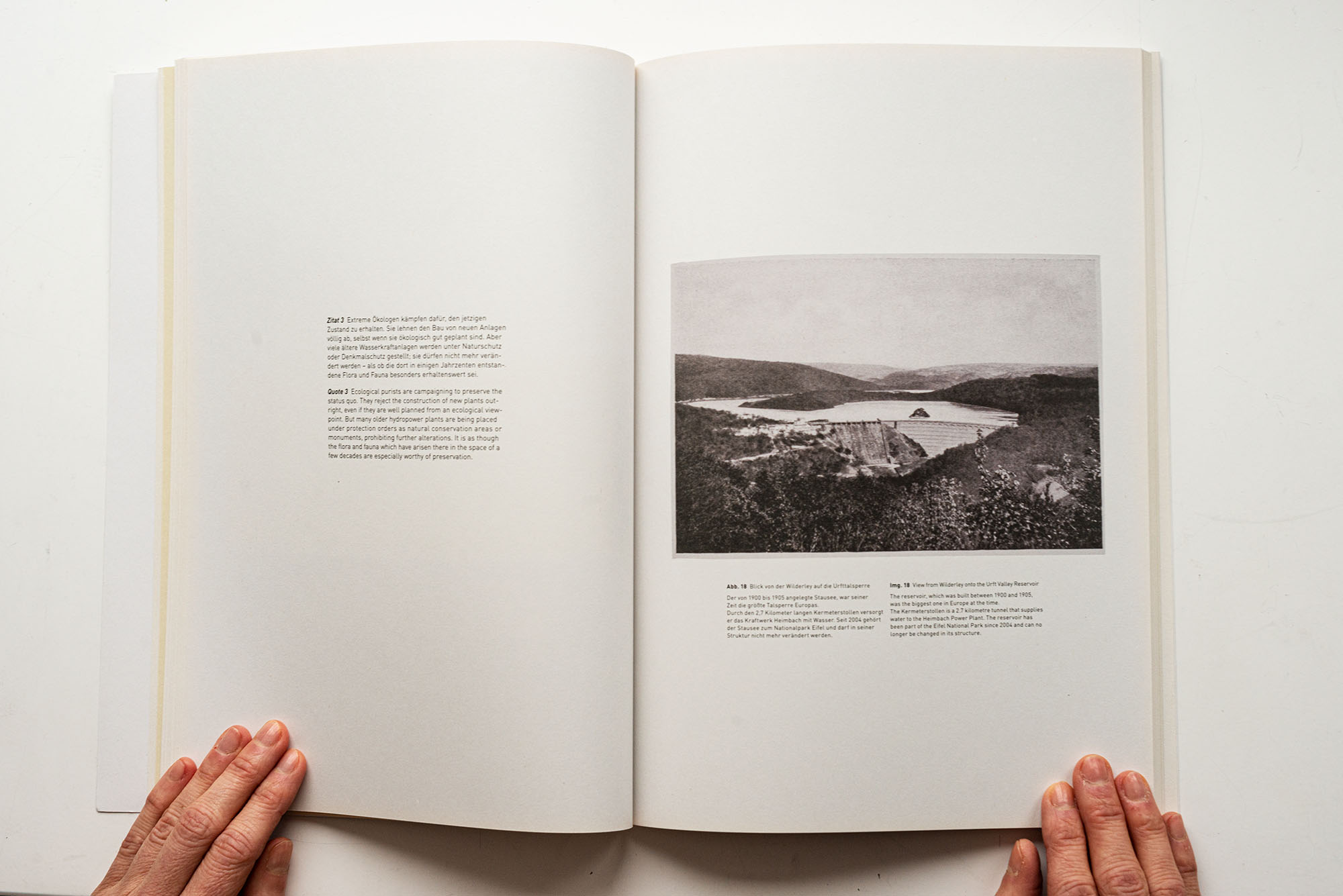
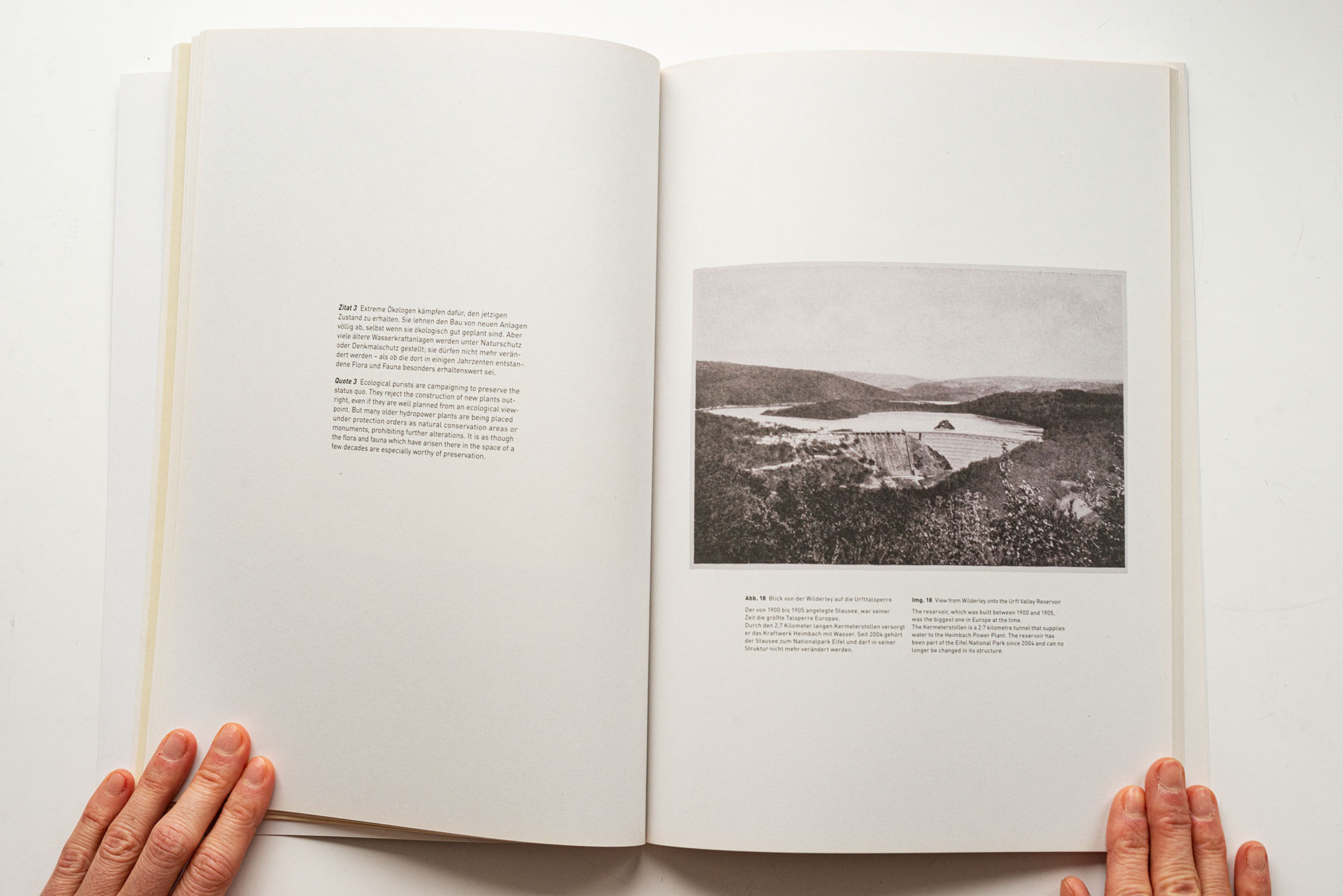
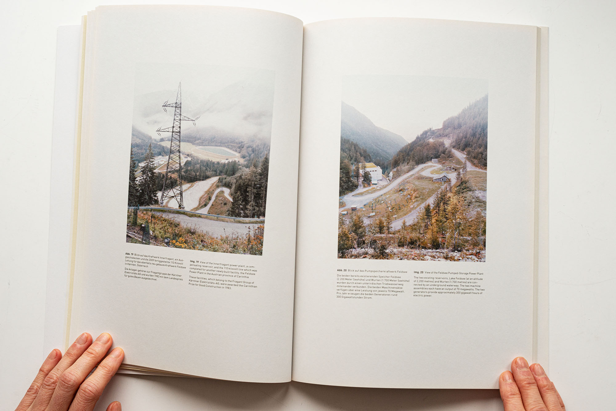
View of the Innerfragant power plant, a compensating reservoir, and the 110 kilovolt line which was completed for another newly built facility, the Feldsee Power Plant in the Austrian province of Carinthia. These facilities, which belong to the Fragant Group of Kärntner Elektrizitäts-AG, were awarded the Carinthian Prize for Good Construction in 1983.
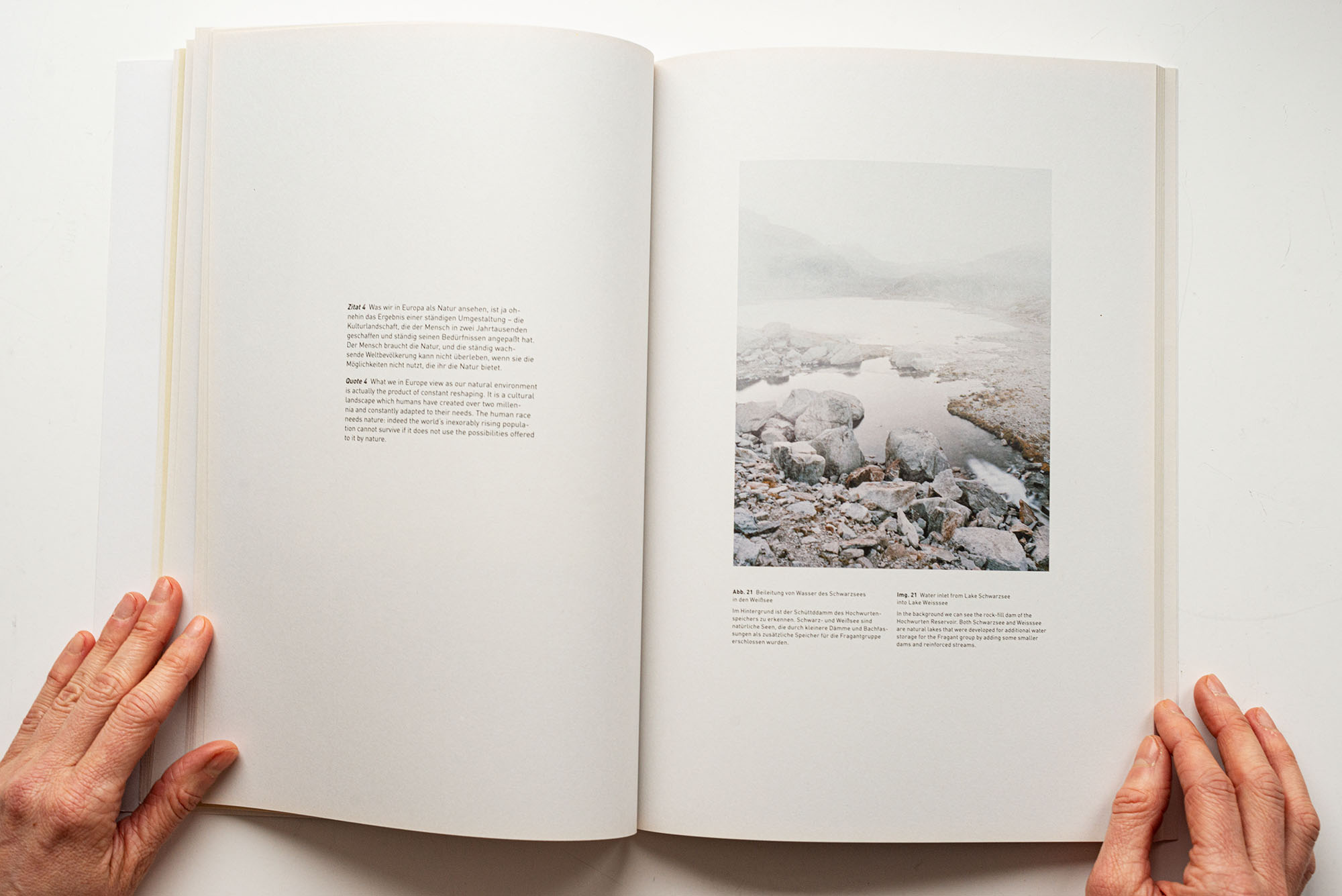
Water inlet from Lake Schwarzsee into Lake WeissseeIn the background we can see the rock-fill dam of the HochwurtenReservoir. Both Schwarzsee and Weisssee are natural lakes that were developed for additional water storage for the Fragant group by adding some smaller dams and reinforced streams.
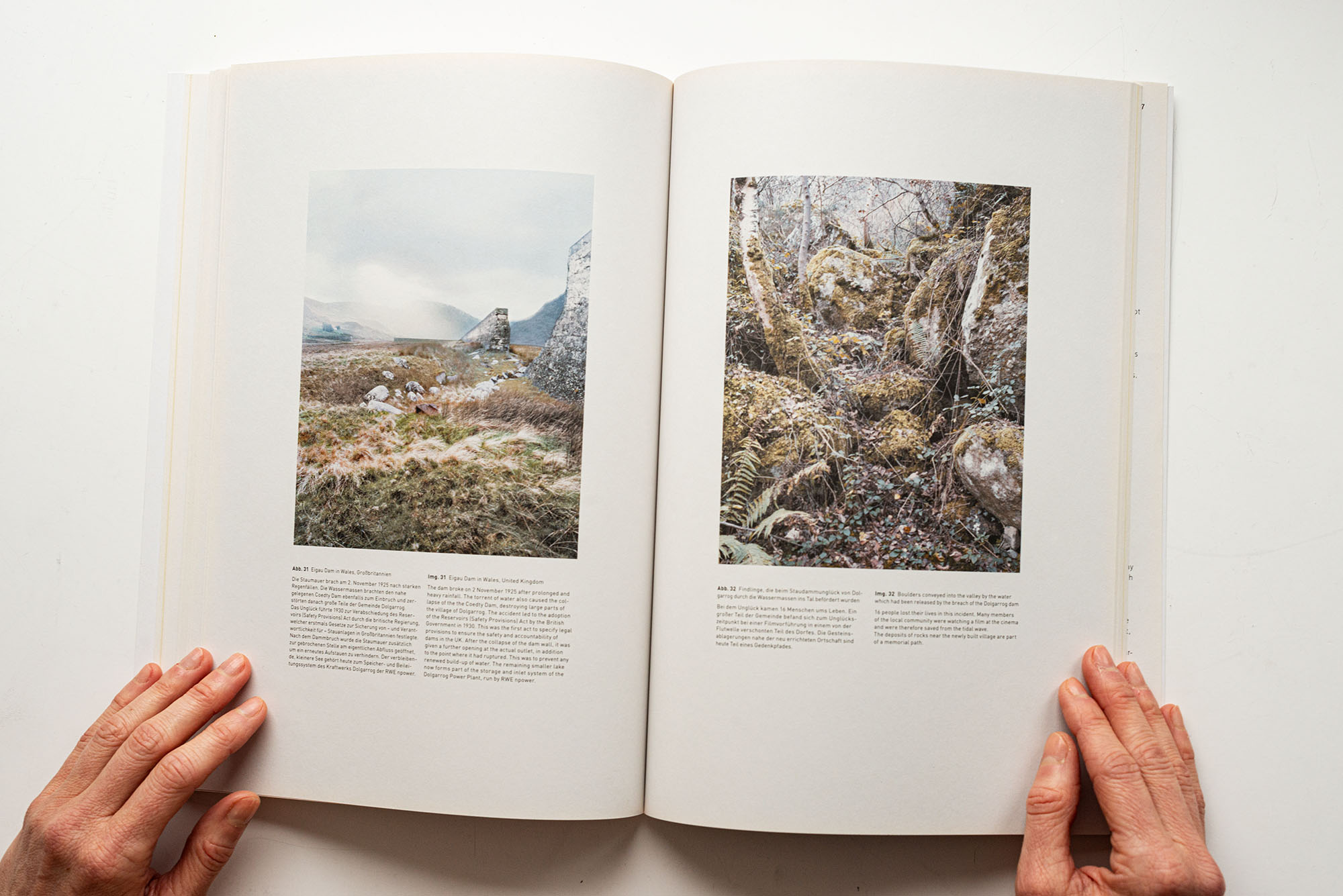
EIGAU DAM – DOLGARROG, WALES
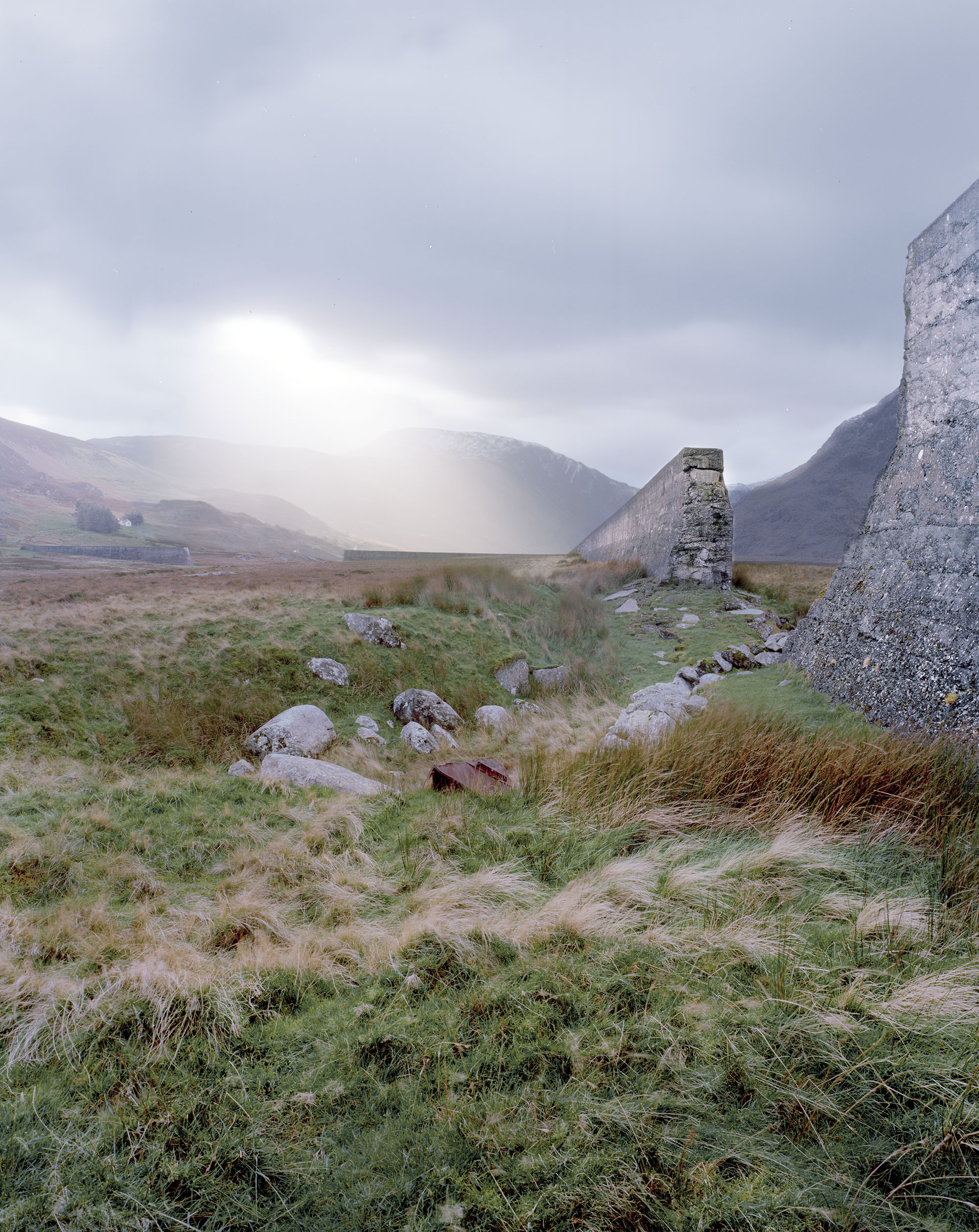
Eigau Dam in Wales, United KingdomThe dam broke on 2 November 1925 after prolonged and heavy rainfall. The torrent of water also caused the collapse of the the Coedty Dam, destroying large parts ofthe village of Dolgarrog. The accident led to the adoption of the Reservoirs (Safety Provisions) Act by the British Government in 1930. This was the first act to specify legal provisions to ensure the safety and accountability of dams in the UK. After the collapse of the dam wall, it was given a further opening at the actual outlet, in addition to the point where it had ruptured. This was to prevent any renewed build-up of water. The remaining smaller lake now forms part of the storage and inlet system of the Dolgarrog Power Plant, run by RWE nPower.
Boulders conveyed into the valley by the water which had been released by the breach of dam16 people lost their lives in this incident. Many members of the local community were watching a film at the cinema and were therefore saved from the tidal wave. The deposits of rocks near the newly built village are part of a memorial path.
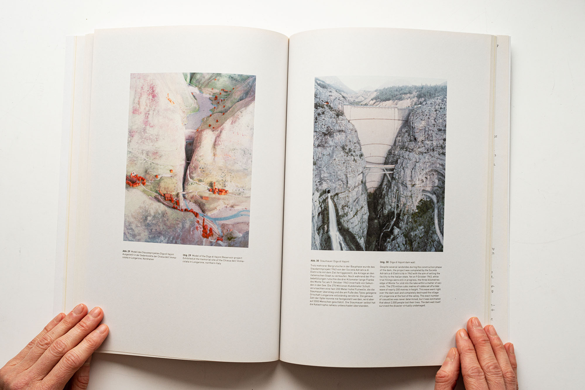
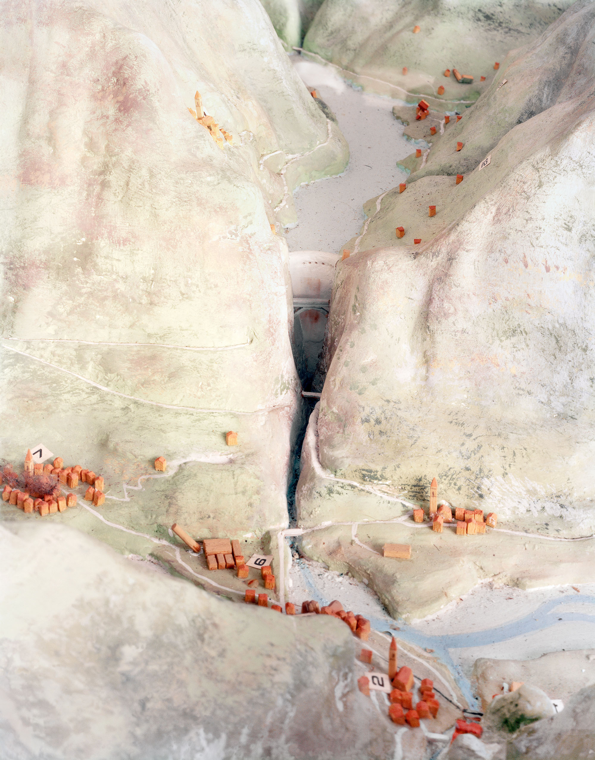
DIGA DEL VAJONT – LONGARONE, ITALY
Exhibited at the memorial site of the Chiesa dell’Immacolata in Longarone, northern Italy

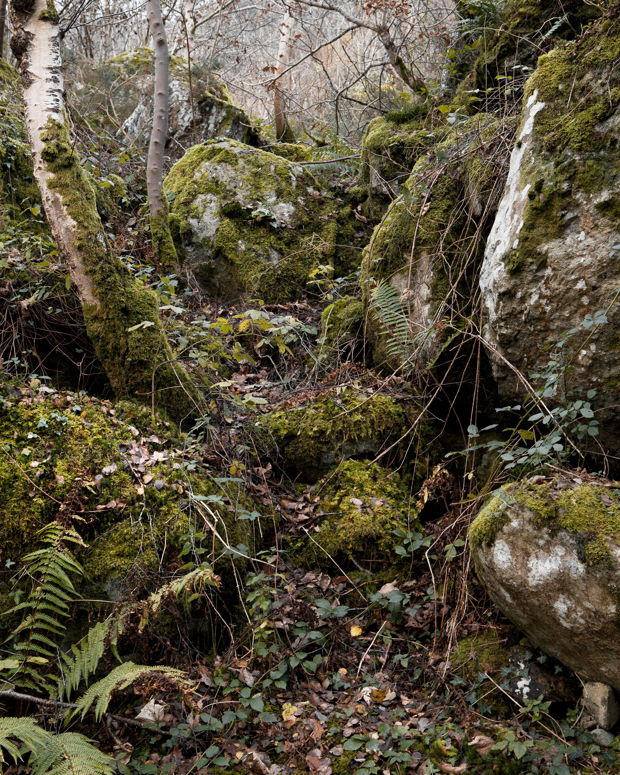
Traces of the landslide that caused the disaster.
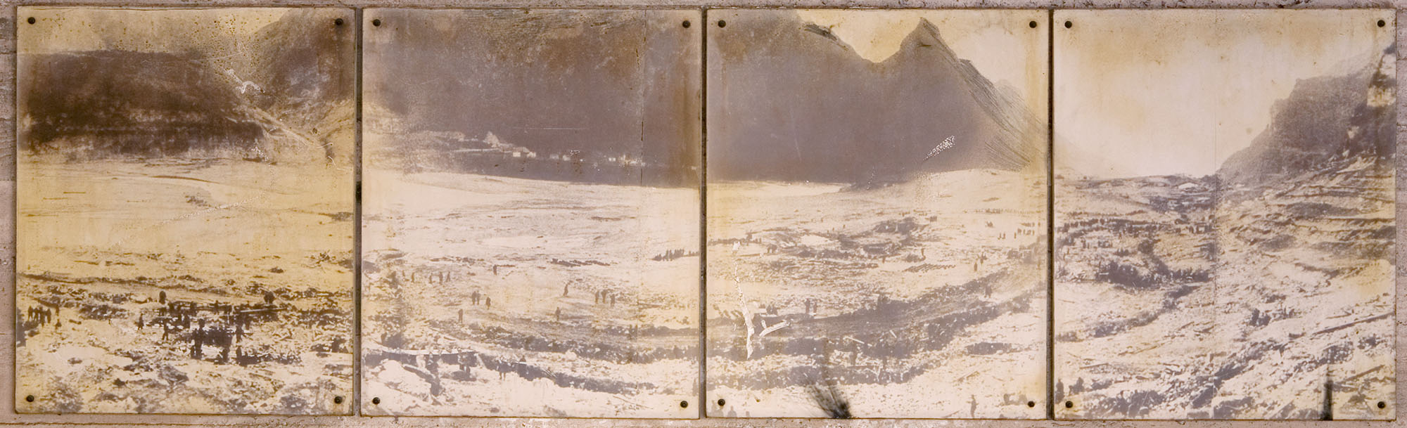
Photograph of the devastated town of Longarone after the disaster.
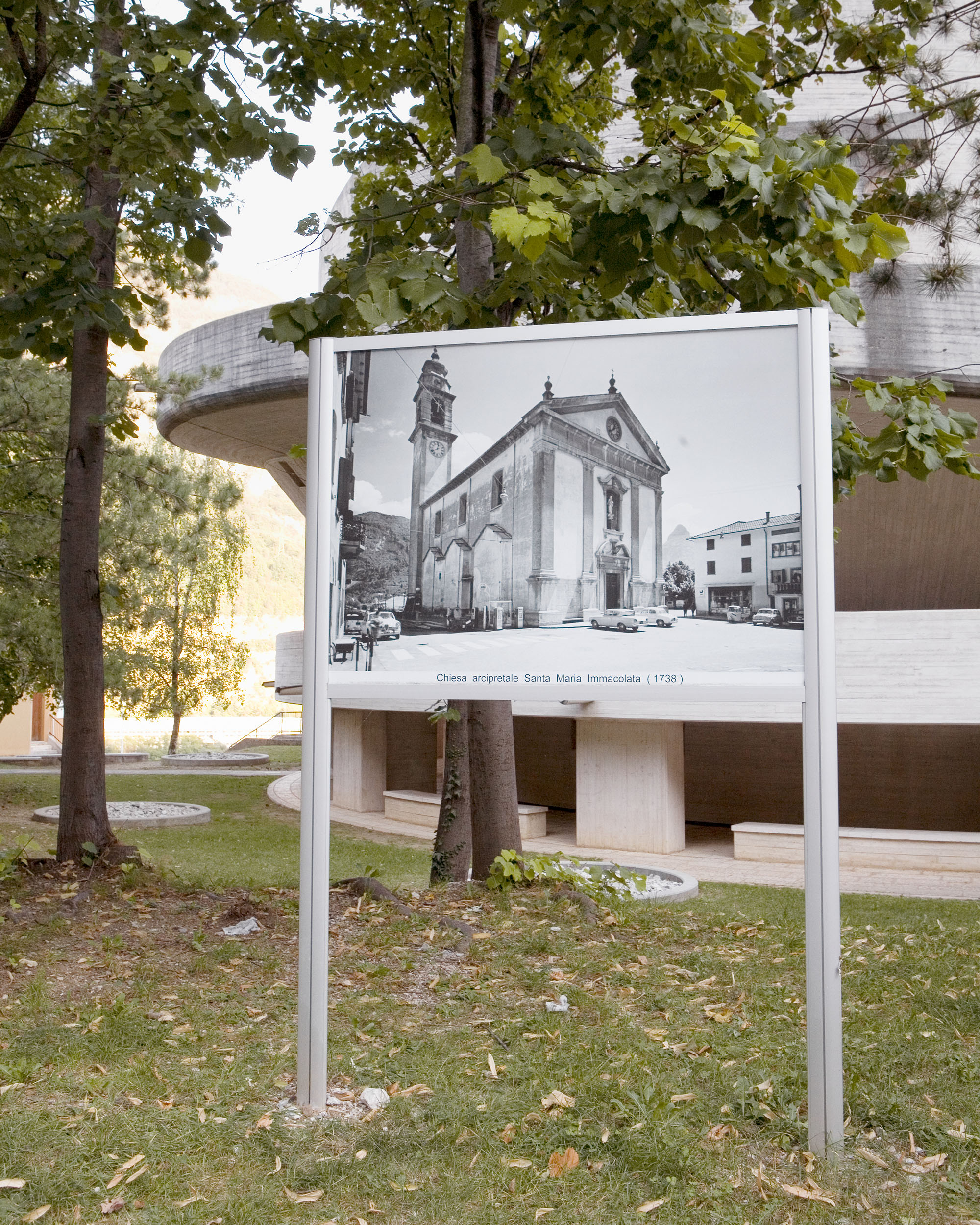
Many of the destroyed buildings in Longarone have been replaced by particularly sturdy concrete buildings in brutalist style.

Despite several landslides during the construction phase of the dam, the project was completed by the Società Adriatica di Elettricità in 1963 with the aim of selling thefacility to the Italian state. Yet on 9 October 1963, while trial fillings were still in progress, the three kilometres edge of Monte Toc slid into the lake within a matter of seconds. The 270 million cubic metres of rubble set off a tidal wave of nearly 200 metres in height. This wave went right over the dam wall and completely destroyed the village of Longarone at the foot of the valley. The exact number of casualties was never determined, but it was estimated that about 2,000 people lost their lives. The dam wall itself survived the disaster virtually undamaged.
The project was realised in the framework of VISIT, the artist-in-residence programme of RWE Stiftung.
